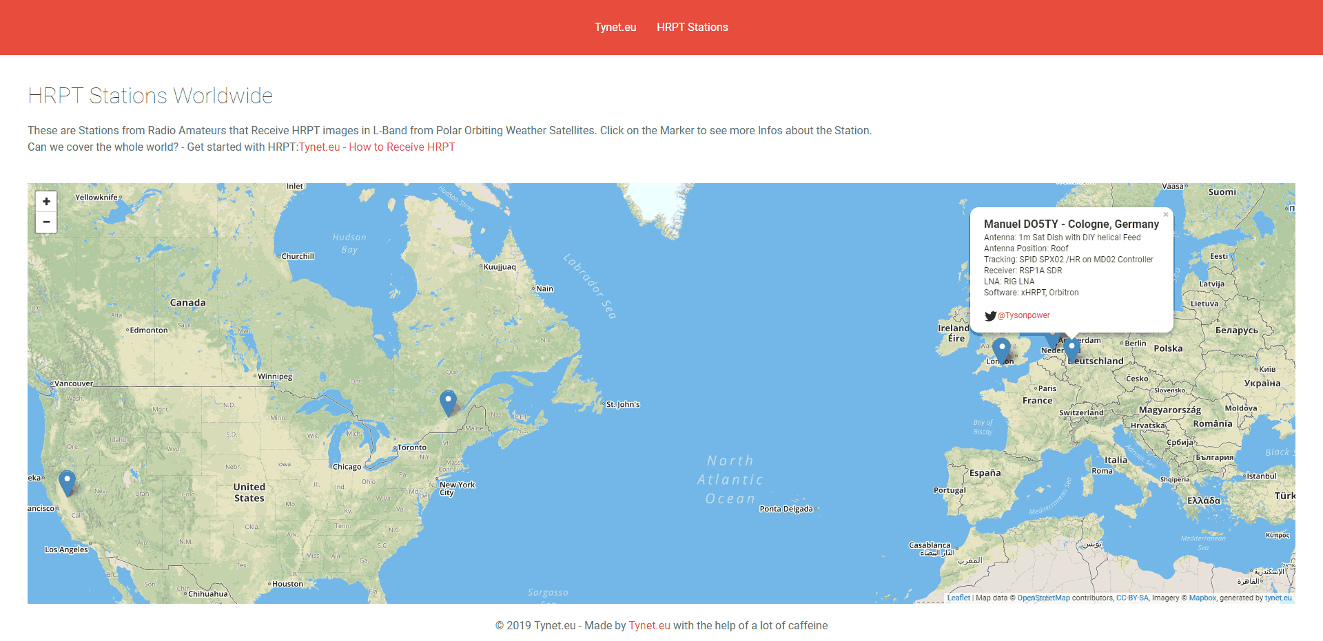
A Worldwide Map for HRPT Weather Satellite Receive Stations
Recently Manuel (DO5TY aka Tysonpower from YouTube) wrote in and wanted to share his website that shows HRPT weather satellite receive stations from around the world on a map, and links to their Twitter pages where you can see the latest images that have been uploaded. The database also describes the SDR and antenna equipment used by each station. Currently there are 10 stations on the map, and Manuel encourages other people to submit their stations to the map database too. If you are interested in contributing your station to the map, please see Manuel's blog post for more information.
Since the satellite broadcasts a live image of what is currently being seen by the weather camera, each receiver location receives a live view of their part of the earth only. The end goal of Manuel's HRPT station map is to crowd source and collect multiple images of different parts of the earth to create a large HRPT composite image. In a previous post, Manuel who is based in Germany was able to create a beautiful composite image covering Germany, the Atlantic Ocean and Canada with the help of a station in Canada. With more contributors larger and more complete composite images of the Earth could be created.
HRPT is a high resolution weather satellite image signal that is broadcast from the same NOAA satellites that provide the more commonly received low resolution APT images at 137 MHz. HRPT is also broadcast from the Feng Yun and Metop-A satellites. However, HRPT transmits at 1.7 GHz, so a high gain dish antenna with motorized tracking mount, LNA and high bandwidth SDR like an Airspy is required to receive it.


Very good idea. But the images are not easy to find.
twitter Is a bit complicated to download images of automatic way.
Jeah, Twitter is not made for automatic Downloads, but you can take a look at them here and ther or just follow the person 🙂
regards,
Manuel – DO5TY
I think that you could be similar to http://websdr.org/ where the data can use for something: predict the climate for example