Tagged: GK-2A

SatDump ReWork Release with Significant Feature and GUI Updates

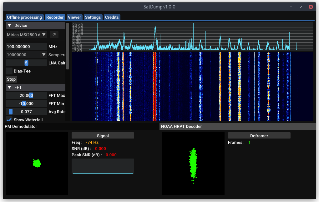
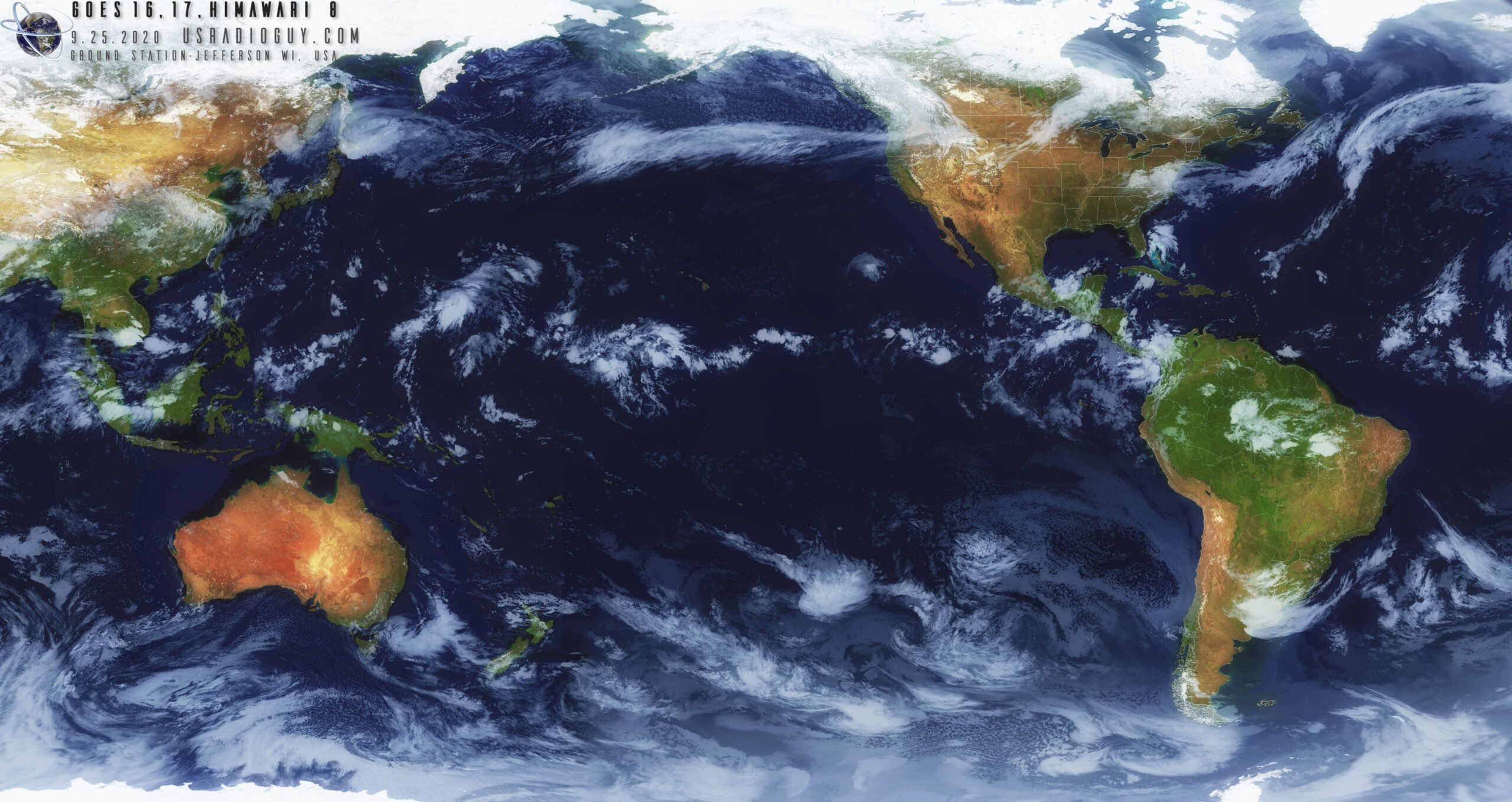
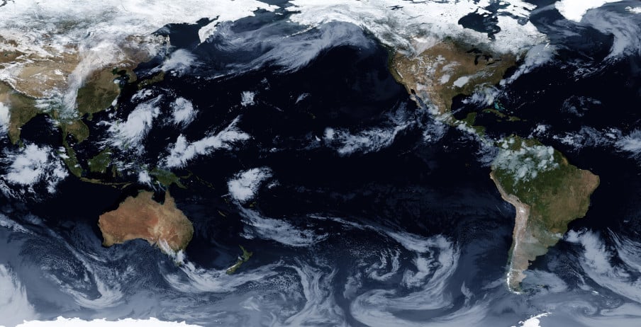
SatDump is a popular piece of software that can be used with RTL-SDRs and other software defined radios for decoding images from a wide array of weather imaging satellites including GOES, GK-2A, NOAA HRPT, FengYun, Electro-L and Meteor M2 LRPT + HRPT, and many others (note: there is no APT support at the moment, but it is planned for the future). It is compatible with Windows, Linux and even has an Android APK available.

Recently author @aang23 has updated the software, noting that he's done an almost full rewrite, including major updates to the GUI. The SatDump blog post goes into greater detail about he updates, but as a summary some of the biggest updates include:

  • A reworking and tidy up of the GUI with improved FFT view
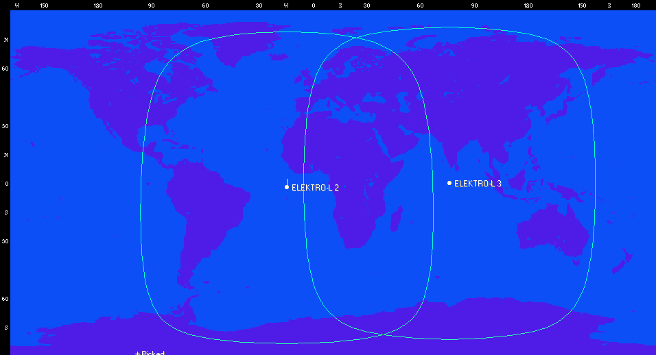
  • A viewer which allows you to view output image products, and create RGB composites
  • A projection tool on the viewer, allowing you to project images onto OpenStreetMap.
  • Upgrades to the plugins system, allowing developers to more easily add support for new satellites / missions and SDRs.
  • The addition of 'products' metadata, allowing users to separate raw channel data
  • The addition of demodulators like DVB-S2, GOES-R GRB, HimawariCast, DVB-S
  • Support for additional SDRs like BladeRF, SDRplay RSP Duo, PlutoSDR and MiriSDRs.
  • Updates to the CLI interface
  • Updated less buggy Android App
SatDump new Live Decoding / Recorder Interface

Layering Geo-Spatial Fire Data onto GOES Satellite Imagery

Thank you to Carl Reinemann (aka usradioguy) for writing in and sharing with us how he has developed a script to layer FIRMS data (Fire Information for Resource Management System US / Canada) onto GOES satellite images (usradioguy blog post) that can be received with an RTL-SDR. We have a tutorial on GOES reception here.

The script is a Windows batch file that downloads FIRMS data from the internet every 12 hours, then converts that data into a format that can be processed by goestools. Once converted the resulting JSON file is uploaded to the Raspberry Pi running goestools. A custom goestool process is then used to layer the data onto the received images.

The result is accurate red polygons on the satellite image in areas where fires have been recorded. With this data visualized it is easy to see where smoke seen on the satellite images is coming from. For example, the image below shows the location of wildfires in the Western USA and the resulting smoke trailing across the continent.

Carl has also tested the fire data layer with GK-2A and Himawari-8 and notes that it works well with images from those satellites as well. 

Fires data in Western USA layered on top of received GOES satellite images.

Elektro-L3 Geostationary Weather Satellite: Easy to Receive LRIT Signal Being Tested

Back in September 2020 we posted about the release of an X-Band decoder for the Elektro-L2 and Elektro-L3 Russian geostationary satellites. These satellites are receivable from Europe, the Middle East, Asia, Africa, South America and Australia. Unlike the HRIT and LRIT L-band transmissions from other geosynchronous satellites like GOES and GK-2A, the X-band Elektro signal is quite difficult to receive, requiring a large dish and more expensive hardware.

However we've recently seen exciting news on Twitter that a new L-band LRIT transmission has been activated on Elektro-L3. Like the Korean GK-2A satellite, this L-band LRIT transmission at 1691 MHz should be much easier to receive requiring only a WiFi dish, SAWBird GOES LNA and an RTL-SDR. We haven't yet confirmed if like GK-2A, the smaller 600 x 400 mm WiFi dish is sufficient, or if Elektro requires the larger 600 x 1000 mm dish size. (See our GOES satellite and GK-2A tutorial for information about the hardware being discussed in this paragraph.)

We note that the Elektro-L3 signal appears to be in testing, and the transmission could be turned on and off, or even turned off permanently. The transmission schedule is also not yet clear although in this recent tweet @HRPTEgor has mapped out some current transmission times for Eletro-L3.

It is hoped that LRIT will also eventually be activated on Elektro-L2, and perhaps even HRIT will be activated too. It is also exciting that more Elektro-L satellites are planned to be launched from 2022 onwards and we expect those to have hopefully LRIT and HRIT transmissions as well. To add further excitement, it is hoped that the L3 LRIT activation means that a LRIT or HRIT signal will be activated on the high elliptical orbit (HEO) northern hemisphere Arctic monitoring ARKTIKA-M1 satellite launched in Feb 2021, as this satellite is derived from the Elektro-L design.

The LRIT activation of Elektro-L3 hopefully means that Europeans should finally have access to a geostationary weather satellite that can be easily received with modest low cost hardware. The current coverage map from Orbitron of the two Elektro satellites is shown below (note that Elektro-L2 LRIT does not appear to have been activated yet).

Elektro-L2 and Elektro-L3 Coverage (Currently only Elektro-L3 LRIT transmissions have been discovered)

Over on Twitter @aang254 has noted that he has already updated his satdump software, adding support for Elektro LRIT decoding, and adding support for all of the available channels and for color. Satdump is available as a binary for Windows, and on Linux can be built from source. Experimentally, Satdump can also be built and run on Android.

The Tweet from @aang254 provides a nice sample image of what can be received.

Information about Receiving the GOES-13 Weather Satellite (Europe Coverage with 1.8m Dish)

For some time now many weather satellite enthusiasts have enjoyed the ability to relatively easily receive live high resolution images directly from the GOES-16, GOES-17 and GK-2A geostationary satellites (tutorial here). However, while much of the world can see at least one of these satellites, European's have been left out.

What may be of some interest to Europeans is that the older GOES-13 (aka EWS-G1) satellite was repositioned in February 2020, and it can now be received in Europe (as well as Africa, the Middle East, Asia, Russia and West Australia) until at least 2024 when it will be replaced.

The important catch however is that GOES-13 is not broadcasting the same easy to receive LRIT/HRIT signals that the other satellites use. The signal is still in the L-Band at 1685.7 MHz, however it is called "GVAR" and it is much weaker and uses 5 MHz of bandwidth. For GOES 16/17 and GK-2A a 1m WiFi grid dish, LNA and RTL-SDR was sufficient, but for GOES-13 you'll need a much larger 1.8m dish, and a wider band SDR like an Airspy. The big dish requirement significantly increases the reception challenge.

We also note that the decoder is being developed by @aang254 and u/Xerbot and it is not yet publicly released. However, they do intend to release it soon. Update:

Over on his blog Carl Reinemann has been collecting some useful information about GOES-13 reception. Over on Reddit u/derekcz has also created a post with some useful information. We've also been talking to @ZSztanga in Poland who has been testing this satellite out, he wrote:

My hardware is: 180cm prime focus dish, with a custom cantenna (120mm diameter). I'm using the SAWBIRD GOES LNA. I will be switching to the + version, because the setup is still lacking a few db SNR. The SDR is the one I use for HRPT: the airspy mini

I found that the USB connection on the airspy generates a lot of noise, so I removed the USB cable, by moving the airspy to the laptop. I use 2m of CNT-400 coax and it works much better now. I get about 2 db SNR more. Thought you might find it interesting.

@ZSztanga's GOES-13 Reception Setup, with 1.8m dish.

We note that there is some interesting differences with GOES-13 images. Since the image is less processed, it is higher resolution (a full resolution image can be found on this Reddit post), as well as not cropped, meaning that the Earth's atmosphere is visible. Please also follow @ZSztang on Twitter for more images.

New GOES Weather Satellite Bundle from NooElec

NooElec have recently released for sale a GOES geostationary weather satellite reception bundle which includes a parabolic grid dish, feed, GOES LNA and RTL-SDR dongle. The bundle should be usable for the GK-2A satellite, as well as HRIT from polar orbiting satellites, although for HRIT you'll need some way to motorize or hand track the satellites.

Typically to receive GOES a 2.4 GHz WiFi grid dish has been used in the past. While the mismatch between 2.4 GHz and the 1.7 GHz used by GOES doesn't cause too much trouble, the dish provided by NooElec has a feed optimized for the 1.7 GHz which should make receiving the signal easier. The bundle also comes with their SAWbird+ GOES LNA, one of their always ON bias tee E4000 tuner based RTL-SDR dongles and a roll of 10m LMR400 cable.

The bundle is currently available on Amazon USA priced at US$179.95. Canadian customers can also order from Amazon.ca for CDN$259.95. Amazon shipping is free within the USA, however shipping this overseas will cost at least US$100 extra due to the weight + additional import fees. That said, the coverage area of GOES is mostly only for the USA, Canada and South America.

If you're interested in GOES or GK-2A satellite reception we have a tutorial written here.

NooElec GOES DIsh
NooElec GOES Bundle Data

Sanchez Scripting Examples For Post-Processing GOES, GK2A, Himawari, Elektro Satellite Images

Recently we posted about new updates to the Sanchez software. The updates allow users to combine images received from multiple geostationary weather satellites such as GOES 16/17, Himawari-8, GK-2A and Electro. The images can also be reprojected into a flat equirectangular image, and then optionally reprojected back into a disk view at any location on earth. Sanchez's original function is also still there which allows users to add a false color underlay image to grayscale infrared images received from the satellites.

Sanchez is a command line tool, so scripts are required to do anything interesting. Over on his page Carl Reinemann has uploaded a page with a number of Sanchez command line examples available. The page shows examples like how to stitch together multiple images, and how to create a stitched time lapse animation. The YouTube video below shows an example of an animation Carl created with Sanchez and GOES 16 and 17 images stitched together.

GOES 16-17 Composite imagery

And the image below is an example of an image of Himawari 8, GOES 16 and 17 he stitched together with Sanchez.

GOES 16 and 17 composite created by Carl Reinemann via Sanchez

Sanchez Updates: Combine Weather Images from GK-2A, Himawari-8, GOES 16/17 Satellites into one Composite Image

Back in August we posted about the release of Sanchez, a tool originally designed to apply a color underlay image to grayscale infrared images received from geostationary weather satellites such as GOES 16/17, Himawari-8 and GK-2K. The tool has recently been updated with some very nice new features.

One of the new features is the ability to composite together images obtained from multiple satellites in order to form a full equirectangular image of the earth with live cloud cover. Another feature is the ability to use two or more images from different satellites to reproject back to geostationary projection at a specified longitude, essentially creating an image from a virtual satellite.

Image composed of GK-2A, Himawari-8, GOES-16 and GOES-17 satellites (full resolution images available at https://github.com/nullpainter/sanchez/wiki/Sample-images

Sanchez: Create False Colour Images from GOES/Himawari/GK-2A Infrared

With an RTL-SDR, an appropriate satellite antenna and LNA it is possible to receive visible light images from geostationary satellites such as GOES/Himawari and GK-2A. However, in a 24 hour cycle there will only be one or two images that show the Earth fully illuminated by the sun. The rest of the day parts or all of the Earth will be dark with not even clouds visible. To get around this the satellites also use an Infrared (IR) camera which can see clouds at all times. However, these images are greyscale and not very visually appealing.

To fix this aesthetic issue there is now a recently released multiplatform tool called "Sanchez" which will combine a high resolution underlay image with the greyscale IR image in order to create a more beautiful image. The software is command line based and can run on a batch of collected images.

False colour satellite images made by Sanchez