A Browsable Archive of Historical Weather Satellite Data
Thank you to Meti for writing in and sharing his browsable archive of historical weather satellite data (further information here). The archive is designed to store weather satellite data, whether in baseband IQ format, frames, or images, for scientific, educational, or preservation purposes.
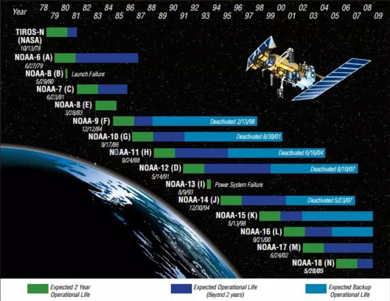
With NOAA POES now fully shut down, the archive could be useful for individuals who didn't have the opportunity to decode a NOAA satellite for real, or perhaps for those who will want to relive their old hobby one day. Meti writes:
I've been working on setting a weather satellite data archive up; a lot of these incredible satellites are lost to time because people didn't save the data or had it deteriorate over the years, as has been proven with the ongoing POES decommissioning!
My goal is to create a browsable archive of historical satellite data that is downloadable and re-decodable by others who didn't and/or don't have the opportunity to catch the satellites in question themselves for scientific, educational, or just preservative purposes.
I've been working hard asking around various people and groups for the possibility of them keeping some data from as many different satellites as possible, but still have large gaps in several satellites. I was wondering if it were possible to try to publish this archival effort on the blog to try to get more outreach than word of mouth?
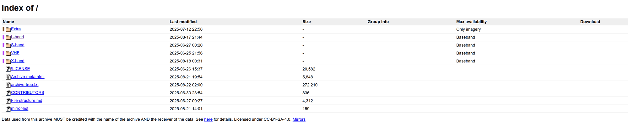
The archive currently stands at 430 gigabytes of data with about 100 more awaiting processing due to missing pipelines, already spanning more than 4 decades!
The archive currently stores a variety of different satellites and their data products, and some in the archive even have the raw IQ data, which occupies a significant amount of hard drive space.
However, Meti notes that many satellites are still missing from the archive, and he would like to reach out to the community for submissions. If you have any data from the following, please reach out to Meti.
GEO:
- Meteosat wefax
- Meteosat xRIT (Only have very limited data)
- GOES-N LRIT/MDL/GVAR/Sounder SD (Before it became EWS-G! So over the US)
- Elektro-L1 xRIT/RDAS
LEO:
- NOAA APT older than NOAA 12
- NOAA HRPT from any sat besides 15/18/19
- Seastar (OrbView-2) HRPT
- MetOp LRPT !!! (Metop-A transmitted for a few days) - Meteor M1 HRPT
- Meteor 3M APT/HRPT
- Meteor 1/Priroda/2 APT (other than Meteor 2-21. NOT M2!)
- FengYun 2A/B/C/D/E/F (S-)VISSR (Or LRIT)
- Fengyun 1 CHRPT
Catch-all
- Any L-band prior to ~2000
- Any VHF prior to ~1990
- Any anomalies - instrument failures leading to strange receptions (i.e. NOAA 17 failing APT broadcasts). THIS IS EXCLUDING NOAA-15 post 2020 and any user-side issues (weak reception, sample drops etc.)
You can find more information about the project and how to contribute on this linked page.