Open-Weather: A Browser Based NOAA APT Satellite Image Decoder
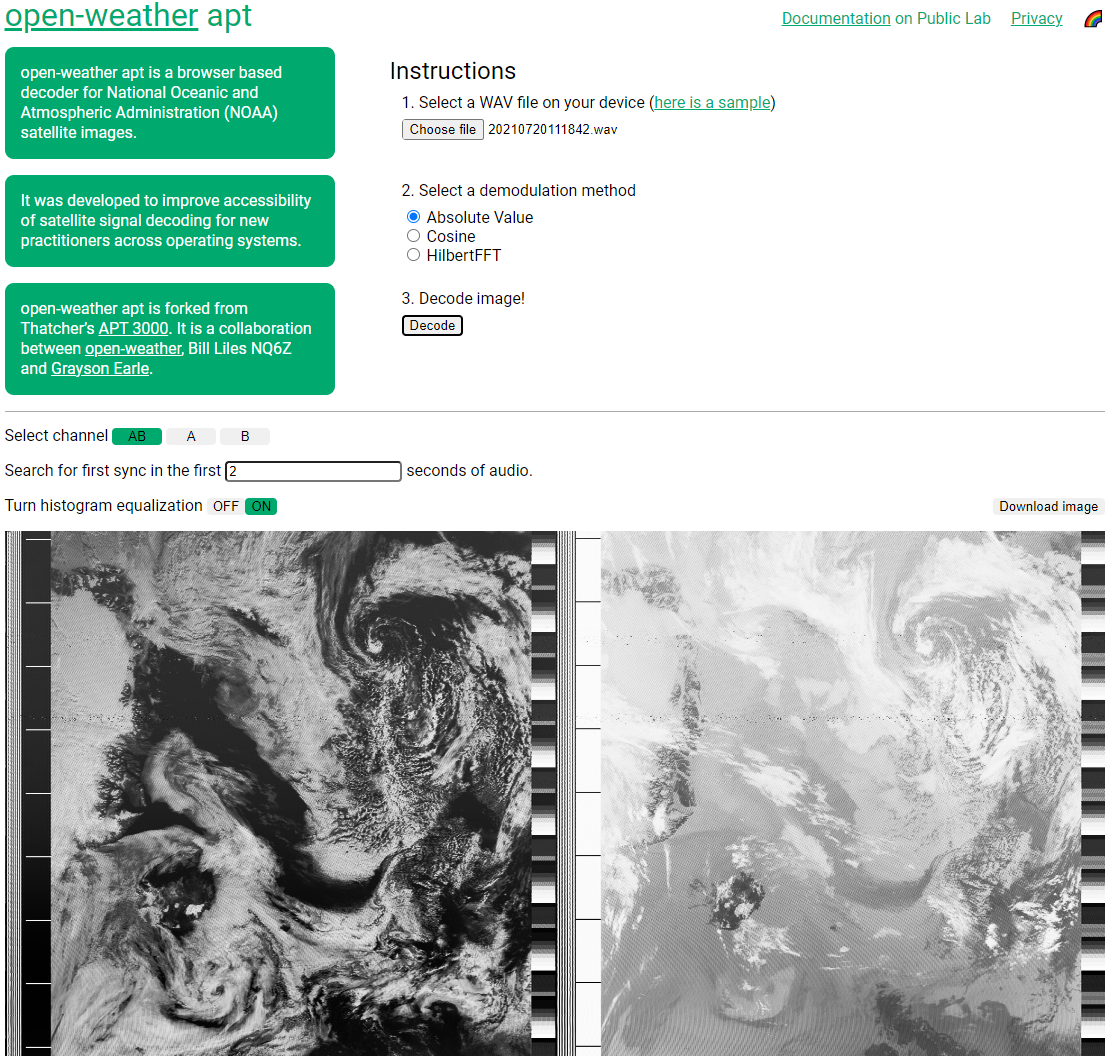
Thank you to Sasha Engelmann for letting us know about the release of the Open-Weather community's web browser based NOAA APT decoder. The decoder allows for easy NOAA satellite decoding by allowing you to upload a wav file recording of a NOAA satellite pass, and it will decode it into an image within the browser.
The project emerged from a desire to understand the process of decoding APT audio recordings into NOAA satellite images, and a need for an accessible browser-based decoder for new practitioners during open-weather DIY Satellite Ground Station workshops.
While we were inspired by Thatcher's APT 3000, we felt accessibility, documentation and features could be expanded and improved. open-weather apt allows you to select an audio file on your computer, choose a demodulation method, add histogram equalisation and download images. The website does not store your personal data, including your location or any files you upload.
Documentation of the decoder is available on Public Lab here: https://publiclab.org/
notes/sashae/05-03-2022/an- accessible-browser-based- decoder-for-noaa-images open-weather apt is forked from Thatcher's APT 3000. It is a collaboration between open-weather, Bill Liles NQ6Z and Grayson Earle.
Introducing open-weather apt, an #accessible #opensource browser-based decoder for @NOAA #satellite images! 🛰️https://t.co/d3mjl3vs8d
— Sasha Engelmann (@sashacakes) August 16, 2022
You can decode #noaa images using 3 different methods 😃 find the 1st sync 👀 add contrast 🌞 without new software 🌈#openweather #hamradio pic.twitter.com/Z0OV6TkiSW
Read the documentation on @PublicLab to learn more about satellite signal processing, the three demodulation methods and how a sound becomes an image of the earth 📸https://t.co/DZke3aj5uy pic.twitter.com/yYaT5Gy6q2
— Sasha Engelmann (@sashacakes) August 16, 2022
