Tagged: Himawari

Sanchez Scripting Examples For Post-Processing GOES, GK2A, Himawari, Elektro Satellite Images

Recently we posted about new updates to the Sanchez software. The updates allow users to combine images received from multiple geostationary weather satellites such as GOES 16/17, Himawari-8, GK-2A and Electro. The images can also be reprojected into a flat equirectangular image, and then optionally reprojected back into a disk view at any location on earth. Sanchez's original function is also still there which allows users to add a false color underlay image to grayscale infrared images received from the satellites.

Sanchez is a command line tool, so scripts are required to do anything interesting. Over on his page Carl Reinemann has uploaded a page with a number of Sanchez command line examples available. The page shows examples like how to stitch together multiple images, and how to create a stitched time lapse animation. The YouTube video below shows an example of an animation Carl created with Sanchez and GOES 16 and 17 images stitched together.

GOES 16-17 Composite imagery

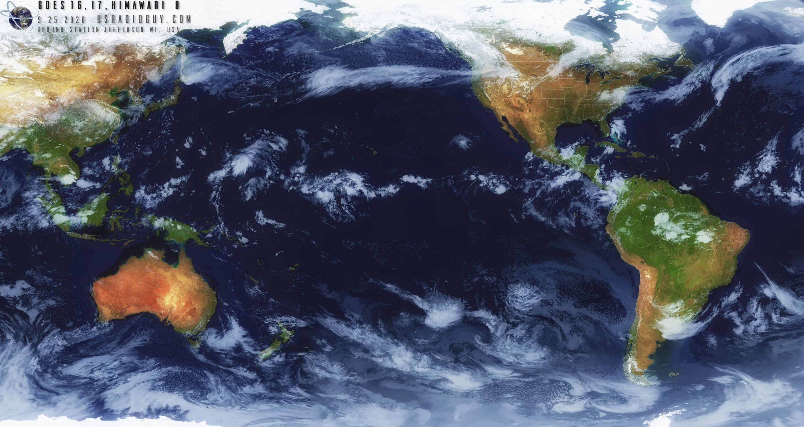
And the image below is an example of an image of Himawari 8, GOES 16 and 17 he stitched together with Sanchez.

GOES 16 and 17 composite created by Carl Reinemann via Sanchez

Sanchez Updates: Combine Weather Images from GK-2A, Himawari-8, GOES 16/17 Satellites into one Composite Image

Back in August we posted about the release of Sanchez, a tool originally designed to apply a color underlay image to grayscale infrared images received from geostationary weather satellites such as GOES 16/17, Himawari-8 and GK-2K. The tool has recently been updated with some very nice new features.

One of the new features is the ability to composite together images obtained from multiple satellites in order to form a full equirectangular image of the earth with live cloud cover. Another feature is the ability to use two or more images from different satellites to reproject back to geostationary projection at a specified longitude, essentially creating an image from a virtual satellite.

Image composed of GK-2A, Himawari-8, GOES-16 and GOES-17 satellites (full resolution images available at https://github.com/nullpainter/sanchez/wiki/Sample-images

Sanchez: Create False Colour Images from GOES/Himawari/GK-2A Infrared

With an RTL-SDR, an appropriate satellite antenna and LNA it is possible to receive visible light images from geostationary satellites such as GOES/Himawari and GK-2A. However, in a 24 hour cycle there will only be one or two images that show the Earth fully illuminated by the sun. The rest of the day parts or all of the Earth will be dark with not even clouds visible. To get around this the satellites also use an Infrared (IR) camera which can see clouds at all times. However, these images are greyscale and not very visually appealing.

To fix this aesthetic issue there is now a recently released multiplatform tool called "Sanchez" which will combine a high resolution underlay image with the greyscale IR image in order to create a more beautiful image. The software is command line based and can run on a batch of collected images.

False colour satellite images made by Sanchez