NOAA-APT Decoder Updates: False Color, Pass Prediction and more
In the past we've posted a couple of times about the NOAA-APT decoder software as it is a worthy alternative to the now abandonware software WXtoIMG. However, it lacks certain features which makes WXtoIMG still the go to program for NOAA weather satellite decoding.
As NOAA-APT is open source it has recently seen a few new updates from another contributor, as well as the original author. These changes make it quite a bit more useful, although admittedly not perfect. Hopefully we'll see continued refinement over time. Regardless, this is still a great piece of software which is open source and multi-platform. Martin Bernardi, the original contributor writes:
Although I wasn't planning to continue working in my program, the quarantine happened so I worked on the program a little. Later, a person (Arcadie Z) added more features too, so I created a new version in case you want to add a blog post about it.
Added features since the last blog post:
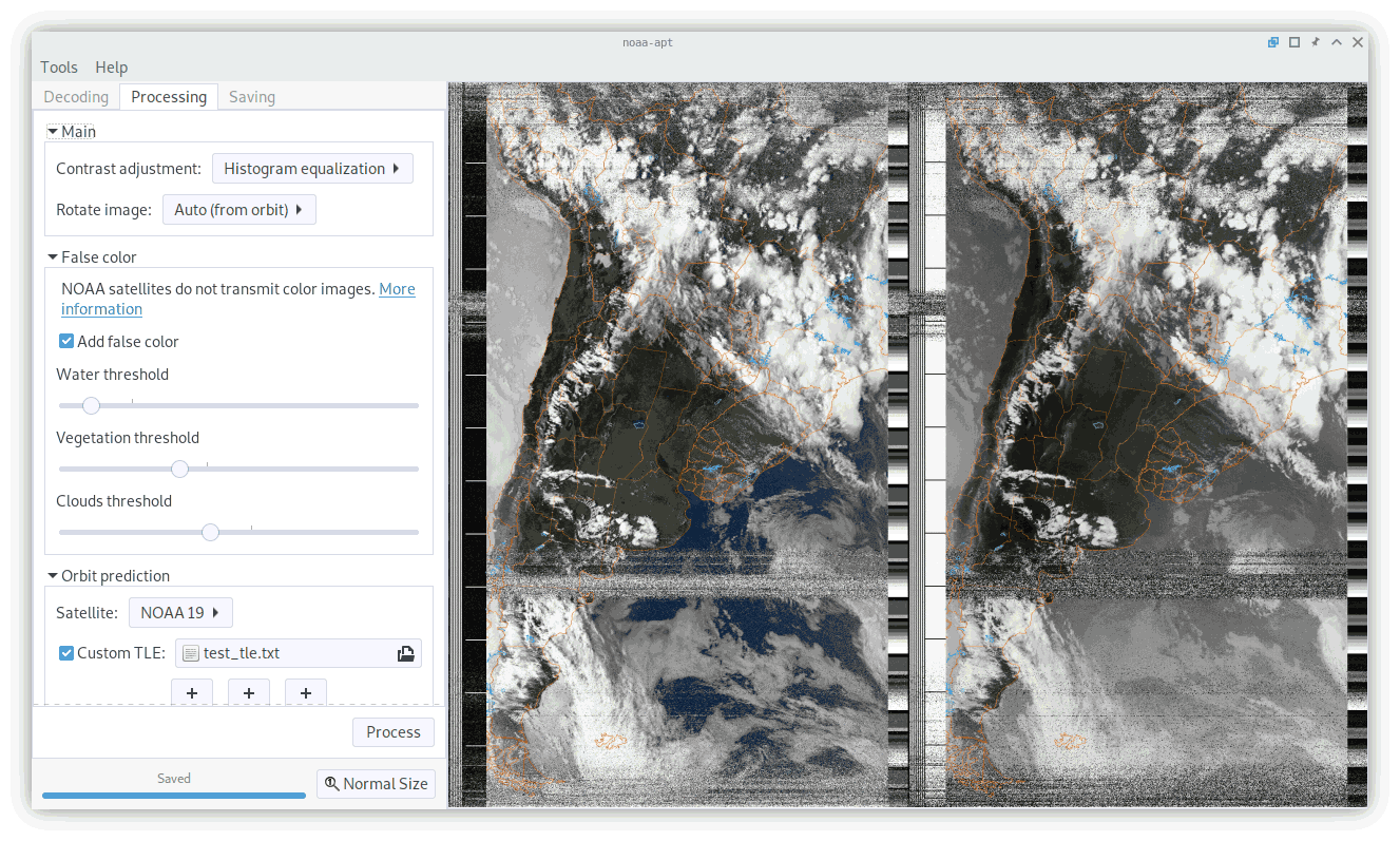
- Redesigned GUI.
- Satellite prediction and map overlay (but has offsets I can't fix yet).
- False color images
- Histogram equalization (improves the contrast and brightness of images)
- Automatic image rotation depending on pass direction
In the end, the map overlay and false color does not work very well, but it is better than nothing I guess.