IridiumLive – New Software to Plot Iridium Satellites as They Pass Overhead with an RTL-SDR
Over on GitHub, microp11, the author of Scytale-C has released a new browser based program called IridiumLive which allows you to visualize the live positions of Iridium satellites as they pass overhead. Iridium is a satellite constellation that provides services such as global paging, satellite phones, tracking and fleet management services, as well as services for emergency, aircraft, maritime and covert operations too.
The software uses gr-iridium as the data source, which is an RTL-SDR and other SDR compatible Iridium satellite decoder. See this very interesting talk by the gr-iridium authors for more information, and this video by Techminds which shows how to install and run gr-iridium.
Also in order to receive Iridium satellites in the first place, you'll need an appropriate antenna such as our "RTL-SDR Blog Active L-Band 1525 - 1637 Inmarsat to Iridium Patch Antenna Set" which is currently available on our store.
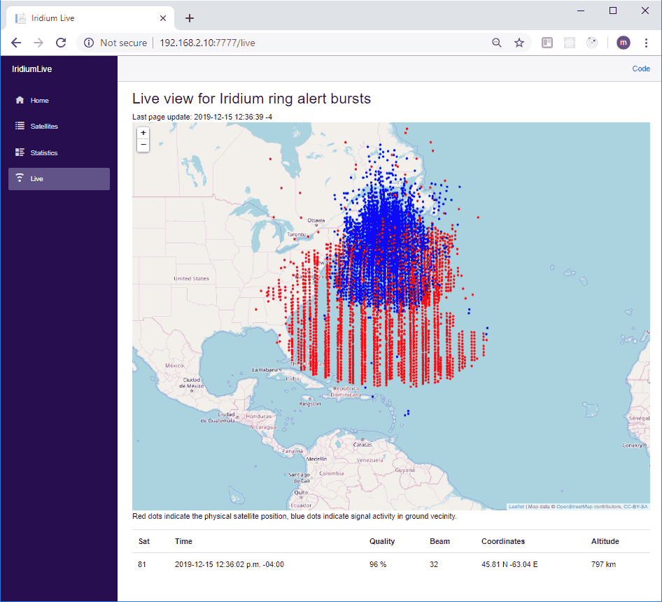
Instructions for installing and running IridiumLive are available on the Git readme. Once installed you can browse to the IridiumLive web page on your local network, and view the tracks of the Iridium satellite fleet as they pass overhead, as well as the locations of Iridium signal activity from the ground.


Can these be received west of the Mississippi River. Preferably Texas
Can a system that has 100% coverage of earth ( https://www.groundcontrol.com/Iridium_Coverage_Map.htm ) including full polar coverage be received up in Texas, I’m going to guess “No”. Because Texas is not part of earth.
Smart a**. LOL