Receiving Images from the US DoD Coriolis Satellite
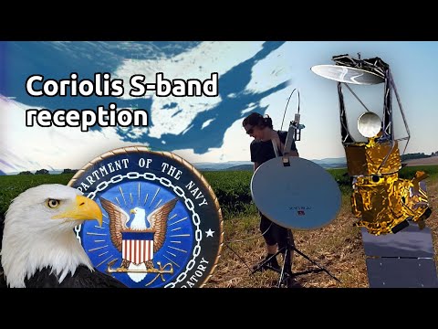
Over on dereksgc's YouTube channel another recent video from his satellite decoding series shows how to download images from the Coriolis satellite, a US Department of Defense satellite launched in 2003, that is among other uses designed to measure wind speed and direction from space using a radiometer.
The entire history of an orbit is only downlinked in the S-band when over an official ground station, however it also has a 'tactical' downlink for live data that the US Navy uses. As the data is unencrypted, with a satellite dish, 2.2 GHz feed, LNA and a software defined radio like the HackRF, anyone can receive the data.
In his video dereksgc explains the satellite, shows his hardware, and demonstrates reception. He then passes the recording into SatDump which results in the images. The images themselves are nothing interesting to look at, as they are produced by a sensor designed to measure wind. But dereksgc shows how multiple images can be composited into something a little more interesting.


Since the information is not encrypted, the satellite dish, 2.2 GHz feed, low noise amplifier (LNA), and radio are all parameters that may be set in software like HackRF. A radiometer can also be used to determine the velocity and direction of wind from outer space.