RTLSDR Scanner Now Supports GPS for Signal Strength Mapping
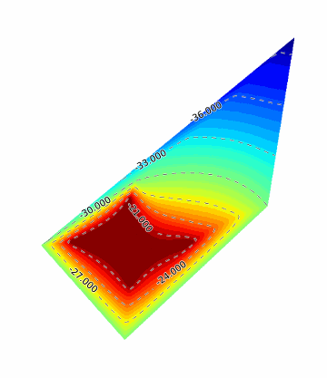
The RTLSDR scanner software has been updated and now supports connection to an external GPS receiver. With a GPS receiver attached to a laptop, the RTL-SDR can be used to make signal strength maps by driving around in a car and monitoring the radio spectrum with RTLSDR Scanner running. The signal strength map can then be viewed in Google Earth, a GIS program or any image viewer.


El Link no funciona.