Tagged: RTLSDR Scanner

An Overview on RF Direction Finding with RTL-SDRs

Thanks to K2GOG of the Hudson Valley Digital Network for writing in a sharing with us his latest blog post which is a useful overview of some direction finding techniques that can be used with RTL-SDR dongles. RF direction finding is the act of using a radio to determine the physical location of a signal.

In his post K2GOG mentions our successfully crowd funded KerberosSDR which will be shipping in January next year. KerberosSDR is our 4x coherent RTL-SDR, and one possible application is to use it as a four antenna phase coherent direction finder. K2GOG explains the phase coherent concept in his post quite elegantly.

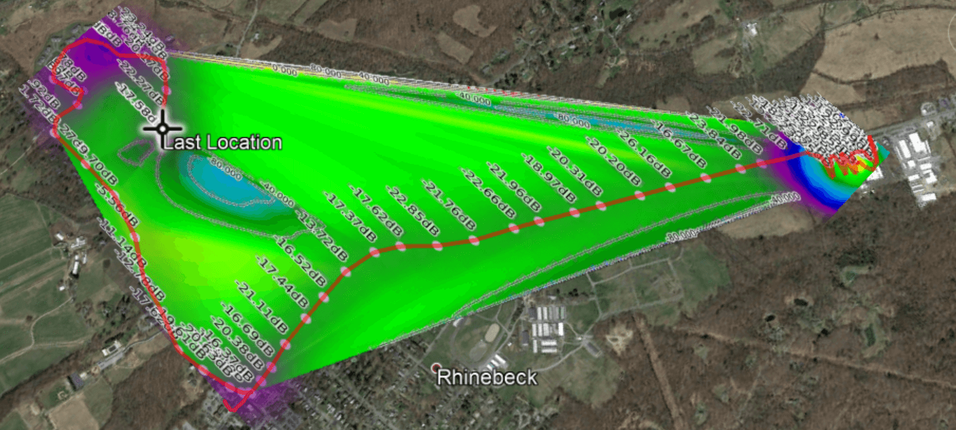
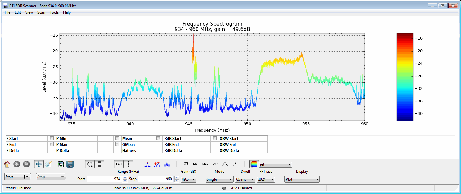
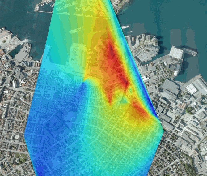
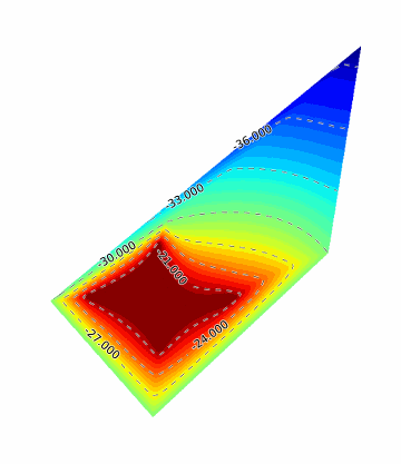
While looking over KerberosSDR, K2GOG was also reminded of another direction finding technique called heat mapping which can be performed with a single RTL-SDR. This process involves driving around with an RTL-SDR and GPS logger, measuring the signal power as you drive and combining it the current GPS coordinates. From that data a heat map can be generated, which shows where the signal is the strongest, and therefore where the likely source is. The RTLSDR Scanner application by eartoearoak makes doing this easy, and in his post K2GOG provide a short tutorial on setting it up.

A heatmap generated by K2GOG with an RTL-SDR, GPS and RTLSDR Scanner.

RTLSDR Scanner Standalone Application Released

RTLSDR Scanner is a program that can be used with an RTL-SDR to do a power scan over a very wide frequency. It works by quickly scanning the selected bandwidth in chunks and stitching the results together. Previously to install this software you had to run an installer which installed many dependencies. However just recently the author has released a standalone version which doesn’t require any installation. To use this version simply download the RTLSDR Scanner .exe file, and place it into the same folder as the official Windows librtlsdr drivers, which can be downloaded from Osmocom.

One useful application that RTLSDR Scanner can be used for is to generate a signal strength heatmap. If you connect a GPS device to your laptop, RTLSDR scanner will record GPS coordinates together with signal strengths as you drive around. From this a heatmap of signal strengths can be generated which can help you to find signal sources, or sources of interference.

RTLSDR Scanner scanning the cellular bands.

Creating a Signal Strength Heatmap with an RTL-SDR

Over on Reddit, user tautology2 has linked to his project which is software that can create a heatmap of signal strengths. His software uses the data that is output from RTLSDR Scanner which is a program that will collect signal strength data over any desired bandwidth and at the same time also record GPS coordinates using an external GPS receiver. RTLSDR Scanner can also create a heatmap by itself, but tautology2’s heatmap is much clearer and has good web controls for choosing the heatmap signal frequency.

Tautology2 writes about his program:

Eartoearoak’s rtl-sdr scanner can save GPS location data along with spectrum samples, I had put USB GPS unit and SDR’s antenna on the top of my car, put my notebook with running scanner on the front seat and driven it around.

Then I saved results both as an image sequence (which you can see at the bottom of the map) and as the raw data in json format. My script (scan2web.rb[3] ) parses raw data, filters out redundant samples (which were captured standing at the traffic lights etc) and computes normalized spectrum power for eight 300-KHz bands for each spatial sample. Results are saved in heatmap.json[4] , which is rendered using Google maps v.3 heatmap API.

The Reddit thread discussing his project can be found here.

Tools used for making the heatmap: Laptop, RTL-SDR with stock antenna and a GPS.
Heatmap of GSM Signal Strengths

Triangulation of a VHF Signal with RTLSDR-Scanner

A few months back we posted about how the the RTLSDR-Scanner software had been updated to include signal triangulation capabilities. Now blogger Tobby has written a post about his attempt at triangulating the source of an encrypted police signal with RTLSDR-Scanner.

To do this he set up a laptop in his car with RTLSDR-Scanner installed and connected his RTL-SDR with stock antenna and a GPS receiver. After driving around for only 15 minutes he was able to get a triangulation heat map of reasonable accuracy.

RTLSDR-Scanner Signal Triangulation Heatmap

Signal Mapping using RTLSDR Scanner and GPS on an iOS Device

Recently we posted how RTLSDR Scanner has been updated to allow interfacing with a GPS device. This allows you to make signal strength maps by driving around and recording both signal strength and GPS location together.

As most people don’t have a dedicated GPS device, Reddit user soooooil has put together a short guide on how he was able to use his iPhone as the GPS device and interface it with RTLSDR Scanner.

RTLSDR Scanner with iOS GPS device.

RTLSDR Scanner Now Supports GPS for Signal Strength Mapping

The RTLSDR scanner software has been updated and now supports connection to an external GPS receiver. With a GPS receiver attached to a laptop, the RTL-SDR can be used to make signal strength maps by driving around in a car and monitoring the radio spectrum with RTLSDR Scanner running. The signal strength map can then be viewed in Google Earth, a GIS program or any image viewer.

RTLSDR Scanner GPS Signal Strength Heatmap