Skies-ADSB Updated to V2.0.3
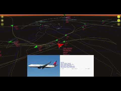
Back in 2022, we first posted about the release of skies-adsb, a browser-based app that uses ADS-B data from an RTL-SDR to provide a 3D view of the air traffic around your area. Recently skies-adsb has been updated from version 1 to version 2, bringing with it several improvements.
The new improvements include:
- Generate custom GeoJSON map layers from Natural Earth, FAA, and OpenStreetMap data
- Aircraft trails visualization
- Enhanced map renderer with multi-layer vector support:
- Aerodromes
- Airspaces
- States / Provinces
- Counties
- Urban areas
- Roads
- Rivers
- Lakes
- New aircraft follow camera controls
The YouTube video below by the author demonstrates some of the new features.


raspberry pi based again, most of us have tablets and laptops far more powerful like windows etc. why not make it for that?
hi Dave
The app itself is a web app. I have experimented with making a native app but in the end I decided to stick with a web app as most people interested in something like this probably already have an existing ads-b tracker setup. So I piggy back on top of that. A Raspberry Pi is not necessary to host the app. You can host it on any lighttpd server. You can also run it locally using Vite–please see instructions for how to do this that are included in the install guide.