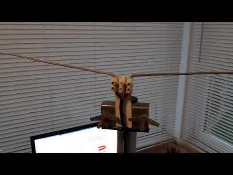
Back in 2017 we posted about Adam 9A4QV's simple V-Dipole antenna design which works very well for receiving NOAA and Meteor weather satellites at 137 MHz. This type of antenna is a lot easier to build compared to a QFH or turnstile, and it results in good performance if built and set up correctly. Over the years he notes that he's received a number of questions asking to clarify the design and so he's uploaded a YouTube video which explains the built and dimensions of the antenna clearly.
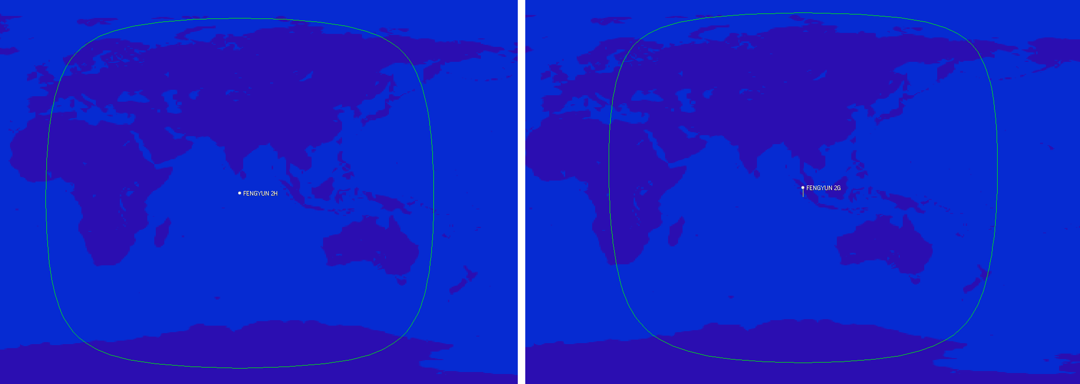
The FengYun-2 line of weather satellites are the Chinese equivalents to GOES, and they are positioned to cover parts of Europe, Africa, the Middle East, Asia, Russia, and Australia. So this is another geostationary weather satellite now available to Europeans which broadcasts in the L-Band at 1687.5 MHz. And unlike the weaker GOES-13 L-Band downlink, the FengYun-2 downlink is much stronger which means that reception with a 120cm satellite dish should be possible. We note that it has not yet been confirmed if the typical 90-100 cm WiFi dishes used with GOES-16 and 17 will be big enough to work. @aang254 writes:
Yesterday I successfully decoded the S-VISSR downlink from FengYun-2H thanks to a recording by @MartanBlaho. It is stronger than PDR on EWS-G1 (see Zbychu's signal https://twitter.com/ZSztanga/status/1329801728162754560…) meaning it should (untested) be doable with a 120cm (or smaller but no confirmation again) dish instead of 180cm.
It covers parts of Europe, Russia and down to Australia. FY-2G and FY-2E (no confirmation for this one yet) are also decodable in the same way. I released an early decoder, that currently is not suitable for automated setups but allows getting images already. A later version (that should come soon-ish) will allow live decoding / autonomous setups in a similar fashion to other satellites.
Also, the res is 2km/px on VIS and 8km/px on IR, so half that of GOES-13 with similar-ish coverage (Europe is less visible though).
(also forgot to say but the bandwidth is under 2Mhz, allowing a rtlsdr to be used)
Gave a go at a FengYun-2H animation with the data recorded by @MartanBlaho.
Sadly some scans focus only on the northen hemisphere but it still turned fine!
Visible channel pic.twitter.com/9FcZlD9oYi
For some time now many weather satellite enthusiasts have enjoyed the ability to relatively easily receive live high resolution images directly from the GOES-16, GOES-17 and GK-2A geostationary satellites (tutorial here). However, while much of the world can see at least one of these satellites, European's have been left out.
What may be of some interest to Europeans is that the older GOES-13 (aka EWS-G1) satellite was repositioned in February 2020, and it can now be received in Europe (as well as Africa, the Middle East, Asia, Russia and West Australia) until at least 2024 when it will be replaced.
The important catch however is that GOES-13 is not broadcasting the same easy to receive LRIT/HRIT signals that the other satellites use. The signal is still in the L-Band at 1685.7 MHz, however it is called "GVAR" and it is much weaker and uses 5 MHz of bandwidth. For GOES 16/17 and GK-2A a 1m WiFi grid dish, LNA and RTL-SDR was sufficient, but for GOES-13 you'll need a much larger 1.8m dish, and a wider band SDR like an Airspy. The big dish requirement significantly increases the reception challenge.
We also note that the decoder is being developed by @aang254 and u/Xerbot and it is not yet publicly released. However, they do intend to release it soon. Update:
My hardware is: 180cm prime focus dish, with a custom cantenna (120mm diameter). I'm using the SAWBIRD GOES LNA. I will be switching to the + version, because the setup is still lacking a few db SNR. The SDR is the one I use for HRPT: the airspy mini
I found that the USB connection on the airspy generates a lot of noise, so I removed the USB cable, by moving the airspy to the laptop. I use 2m of CNT-400 coax and it works much better now. I get about 2 db SNR more. Thought you might find it interesting.
@ZSztanga's GOES-13 Reception Setup, with 1.8m dish.
We note that there is some interesting differences with GOES-13 images. Since the image is less processed, it is higher resolution (a full resolution image can be found on this Reddit post), as well as not cropped, meaning that the Earth's atmosphere is visible. Please also follow @ZSztang on Twitter for more images.
According to the newest calculations performed (by me) on the EWS-G1 data, it has a stunning resolution of about 0.6x1 km/px on the VIS channel and about 2.5x4 km/px on the IR channels. I have yet to confirm my calculations with the doc, which is quite hard to get. pic.twitter.com/kLK8YPDyTV
What I really like about GOES-13 is that the data is unprocessed. That allows to see the atmosphere which is normally cut off on LRIT/HRIT. pic.twitter.com/BWJAVXFnUi
In the past we've posted a couple of times about the NOAA-APT decoder software as it is a worthy alternative to the now abandonware software WXtoIMG. However, it lacks certain features which makes WXtoIMG still the go to program for NOAA weather satellite decoding.
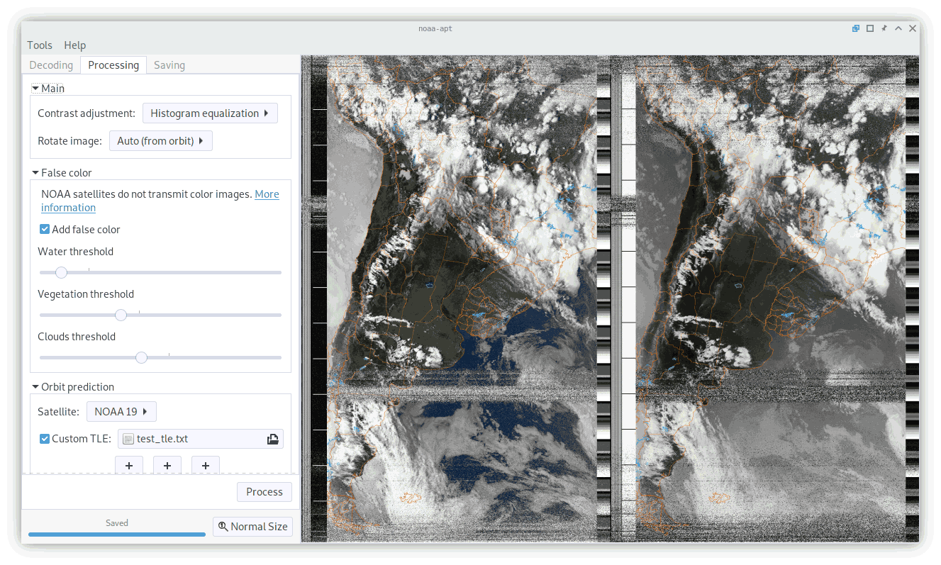
As NOAA-APT is open source it has recently seen a few new updates from another contributor, as well as the original author. These changes make it quite a bit more useful, although admittedly not perfect. Hopefully we'll see continued refinement over time. Regardless, this is still a great piece of software which is open source and multi-platform. Martin Bernardi, the original contributor writes:
Although I wasn't planning to continue working in my program, the quarantine happened so I worked on the program a little. Later, a person (Arcadie Z) added more features too, so I created a new version in case you want to add a blog post about it.
Added features since the last blog post:
- Redesigned GUI. - Satellite prediction and map overlay (but has offsets I can't fix yet). - False color images - Histogram equalization (improves the contrast and brightness of images) - Automatic image rotation depending on pass direction
In the end, the map overlay and false color does not work very well, but it is better than nothing I guess.
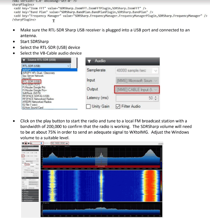
Thank you to John First for submitting his guide all about the setup and use of the software required to receive NOAA weather satellite images on Windows 10 (pdf file) with an RTL-SDR dongle. John's guide covers the use of SDR# for receiving the signal, WXtoIMG for decoding the signal, and Orbitron for tracking the satellite and automatically tuning SDR# when a satellite is in range.
He also explains the use of the VB-Audio Virtual Cable for piping audio between SDR# and WXtoIMG, as well as the DDE Tracking and Scheduling Plugin for interfacing SDR# with Orbitron, and finally how to do NTP clock synchronization to ensure the local time is accurate.
MetOp and FengYun-3 are both polar orbiting satellites that beam back high resolution weather satellite images. Unlike the NOAA polar orbiting satellites which transmit both the easy to receive APT and more advanced HRPT signal, these only transmit a HRPT signal at ~1.70 GHz, so a satellite dish and motorized tracking mount (or hand tracked) is required. You will also need an SDR capable of receiving over 3 MHz bandwidth such as an Airspy Mini or R2. Alan writes:
I recently got FengYun decoding working after the release of my MetOp decoder a while ago. Since gr-hrpt wasn't usable for Windows user without some major hassle, I made some standalone decoders (Windows builds included in the repo) for both MetOp and FengYun.
Decoding is done by first demodulating with the included flowcharts or @petermeteor's, then processed through the decoder which does Viterbi / Differential decoding. The output then needs to be deframed by MetFy3x or any other software that can do so.
FY-3B HRPT decoded with @aang254 's new decoder. I have to train at tracking a little more for the FY! Also used CLAHE to help the contrast. pic.twitter.com/dZ4ACNOBry
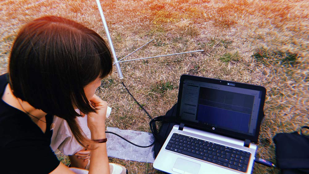
A few weeks ago we posted about Sophie Dyer and Sasha Engelmann's work in creating an artistic performance based on weather satellite reception with SDRs. More recently they have uploaded their own tutorial showing how they receive NOAA APT weather satellite images with an SDR, turnstile antenna and computer. Sasha and Sophie note that they are attempting to create visually rich guides that don't assume any prior knowledge of radio, science or engineering.
From Sasha's Twitter feed we note that they are also working on upcoming public workshops in the UK and Germany on the topic of reflections on what it means to bring an intersectional feminist ethos to satellite image decoding + weather sensing, & new creative collaborations in 2020. If you are interested in their work please follow @sashacakes and @sophiecdyer on Twitter.
Just after our post a few days ago about an art project involving weather satellite reception with SDRs, we received a story submission about an artistic performance with similar weather satellite and SDR themes. The submission from Sasha Engelmann reads:
Open Work, Second Body is a live-streamed performance by designer Sophie Dyer (@sophiecdyer) [M6NYX] and geographer Sasha Engelmann (@sashacakes) [M6IOR] in collaboration with the author Daisy Hildyard. The work was performed twice during Reveil 2020, a global sound arts festival streaming sounds from listening points around the planet on the day of the International Dawn Chorus.
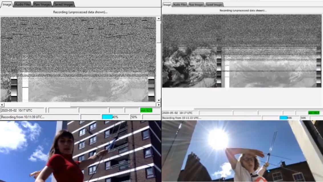
Open Work, Second Body asks: From the climate crisis to coronavirus: what are the tools we need to make sense of events unfolding on vastly disparate scales? Through spoken word, field recordings and live radio reception of two NOAA satellite images, the work probes the porous boundaries between our bodies, local atmospheres and weather systems.
Still image capture from livestream of Open Work, Second Body, AM performance, May 2nd 2020
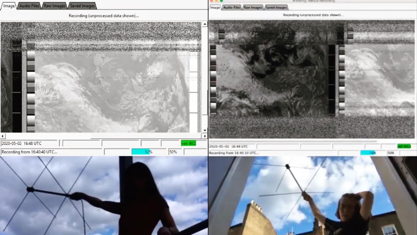
Due to lockdown constraints in London, Sophie and Sasha were not able to be in the same place or to leave their apartments, so they performed the work via simultaneous streams from their respective balconies in South East and North West London. Using RTL-SDRs, Turnstile antennas, Open Broadcast Software and collaborating with two NOAA satellite passes, Sophie and Sasha shared the process of decoding NOAA satellite images with hundreds of viewers around the world, employing spoken word poetry and field recordings to complicate relationships of local and global, weather and climate, the individual and the collective.
Recordings of the performances can be found at the links below.
Still image capture from livestream of Open Work, Second Body, PM performance, May 2nd 2020
Open Work, Second Body is part of Sophie and Sasha's larger artistic research and design project Open Weather, which employs ham radio, open data and feminist theories and approaches to build new and diverse communities around satellite image decoding and weather sensing. The Open Weather web platform will be launched in Summer 2020 and will host an archive of SDR-generated weather images, visually rich how-to guides for those with no radio and engineering experience, and material about Sophie and Sasha's collaborative artistic practice.
For Open Work, Second Body, Sophie and Sasha would like to thank the Soundcamp Team: Grant Smith, Dawn Scarfe, Christine Bramwell, Maria Papadomanolaki and Ciara Drew. They are grateful to Daisy Hildyard for her willingness to be in conversation with them, Bill Liles NQ6Zfor technical advice, Jol Thoms for sound design, Rachel Dedman, Laure Selys and Arjuna Neuman (Radio Earth Hold) for early curatorial input, Akademie Schloss Solitude for the support of a residency, the satellites NOAA 18 and NOAA 19 and the RTL-SDR and wider ham radio community.