Category: Satellite

SDR-Makerspace Talk: Evaluation of SDR boards and toolchains

The Software Defined Radio Academy YouTube channel recently uploaded an interesting talk by Alex Csete (creator of the popular GQRX and GPredict applications), and Sheila Christiansen. Their presentation discusses their work with the European Space Agency (ESA), Libre Space Foundation and how they are running SDR Makerspace's that are helping students create and track cubesats. During the talk Alex and Sheila also describe various SDR hardware, and how they test them for their purposes.

SDR Makerspace (https://sdrmaker.space) is a collaboration between the European Space Agency and Libre Space Foundation, with the objective of bringing innovative open-source SDR technologies to space communications.

Space is a complex environment. Attempting to incorporate SDRs into complex subsystems of space missions without sufficient understanding of the technology can add unnecessary risks and uncertainties to the mission. SDR Makerspace aims to bring open-source SDR technology to the space industry, focusing on the practical aspects of satellite communications, so as to reduce such risks.

Makers, open-source hackers, SDR enthusiasts, and researchers are collaborating on SDR hardware and software activities, focusing on rapid prototyping and development of reusable, open-source SDR components for future CubeSat missions.

The collaboration consists of many activities, which are organized into three main elements: development of reusable GNU Radio components, research and development in cutting edge technologies like AI/ML, and testing of SDR hardware and software.

Current activities are presented with a focus on the testing of the hardware and software. An overview of the investigation into the characteristics, such as, performance under realistic conditions, damage by radiation to essential parts, functionality of FPGA toolchains, the SDR-system’s complexity, and accessibility to the open-source community will also be covered.

Alex Csete, OZ9AEC: SDR-Makerspace: Evaluation of SDR boards and toolchains

Weather Satellite NOAA 15 Appears to have Failed (Again)

Back in April 2018 we posted how the NOAA-15 APT weather satellite that many RTL-SDR users enjoy receiving images from was having problems with it's scan motor resulting in image errors. The satellite recovered from that problem, but today the problem appears to be back and in a much worse way now.

Users on Reddit and Twitter have reported bad images coming in from NOAA 15. Over on Reddit u/rtlsdr_is_fun has provided a post showing an example of a corrupted image, and also provided an IQ and Audio file. On his blog [Karsey] has also posted some interesting looking corrupted images that he's received.

Corrupted NOAA-15 Image Received by [Karsey]
Corrupted NOAA-15 Image Received by [Karsey] (See his post for the full sized images)

NASA have put out a statement indicating that yet again it is a problem with the scan motor, and the problem could be permanent.

The NOAA-15 AVHRR Scan Motor current began showing signs of instability at approximately 0400Z on July 23, 2019. At about 0435Z the current rose sharply to about 302mA where it has remained. Scan motor temperature began rising about the same time and is currently steady at ~26M-0C. Black body temperatures dropped sharply at about the same time. The instrument appears to no longer be producing data.
This behavior is consistent with a scan motor stall, but requires further investigation. Options for recovery are limited.

Having been launched in 1998 with a minimum spec of 2 years operation, NOAA-15 has already well outlived it's time and may finally be failing for real. We hope it will recover, but if not we should be thankful that Russian weather satellite Meteor M2-2 is now fully operational and transmitting beautiful high resolution images.

Slow Scan Moon Bounce Event for 50th Anniversary of the Moon landing

Fifty years ago Neil Armstrong became the first man to step foot on the moon. This weekend on June 20th and 21st 2019 Amateur Radio operators at the [PI9CAM] team have been transmitting Slow-Scan Television images in commemoration of this historic event at the Dwingeloo radio astronomy station in the Netherlands. This station is the oldest rotatable 25-meter radio telescope in the world. 

 Dwingeloo radio astronomy station
Dwingeloo radio astronomy station
An EME SSTV Image
An EME SSTV Image

Slow-Scan Television is a method often employed by ham radio operators to send photos over radio waves. You may be familiar with this from some of our previous articles on the SSTV event held by ARISS for the International Space Station.

Station [S1NDP] has previously sent slow-scan EME images between the PI9CAM team and himself. These images can potentially be heard by anyone within line-of-site with the moon during the operation of this event.

The team transmit in the 23cm band at a frequency of 1296.11 MHz, according to the ARRL even a 2.5 to 3meter dish should be enough for reception assuming you have a 23cm feed for your dish. It will be interesting to see what photos are heard by the end of this event.

Weather Satellite Meteor M2-2 Now Transmitting Images

Reports from Reddit and Twitter are in that the recently launched Meteor M2-2 weather satellite is now functional and broadcasting images at 137.9 MHz. A few people have noted that the reception quality appears to be better than the older satellite.

Thank you to Happysat whose also provided the following information that can be used to receive the images. It appears that a slightly modified version of LRPTDecoder is required:

This version of LRPTDecoder was used to test/debug OQPSK with Meteor M-N2-1 in 2014, it will work on Meteor M-N2-2.
The ini file attached in the archive is processed manually from s files.
Buttons 72K and 80K respectively for the modes “without interleaving” and “with interleaving”.
Also in the archive there are examples for other modes.

Transmissions on LRPT with a OQPSK Modulation are expected tomorrow on most probably 137.900MHz.

Make sure you have version 1.9 of the Meteor QPSK Plugin running in SDRSharp.
http://rtl-sdr.ru/uploads/download/meteor.zip

Changelog:
Optimized QPSK demodulator, OQPSK signal for receiving current and future Meteor.

For people running Tracking DDE Client Plugin make sure you have the following entries in the scheduler:

METEOR-M2_2

radio_Start
radio_modulation_type<wfm>
radio_center_frequency_Hz<138380050>
radio_frequency_Hz<137900000>
radio_bandwidth_Hz<90000>
OQPSK_demodulator_Start
send_tracking_frequency_On

Edit to your path! for MeteorGIS Custom ini file start_programm_Path<C:\Meteor\MeteorGIS\MeteorGIS.exe>

Edit to your path! for MeteorGIS Custom ini file start_programm_Path<C:\Meteor\MeteorGIS\MeteorGIS_M_N2-2.bat>

Edit to your path! Without MeteorGIS start_programm_Path<C:\AMIGOS\run.bat>

send_Tracking_Frequency_Off
OQPSK_demodulator_Stop
radio_Stop

Download:

https://cloud.mail.ru/public/2Se9/9bj36m6AP

Mirror:

http://happysat.nl/2015.3.20.15.zip

Спасибо Олегу, Нцомз и Роскосмосу!

Happysat

Investigating the Galileo Satellite Navigation System Outage with a LimeSDR

Galileo is a European Union owned satellite navigation system. Galileo was created so that the EU does not need to rely on the US GPS or the Russian GLONASS satellites, as there is no guarantee that these systems won't be purposely turned off or degraded by their governments at any time.

Unfortunately since July 11 the Galileo system has been out of service. Not much information about the outage has been provided, but it appears to be related to problems with the Italian ground based Precise Timing Facility which consists of two ultra high precision atomic clocks that keep the Galileo systems' reference time. (We note that recently within the last few hours of this post, most satellites seem to have come back into operational status, but the EGSA website still reports an outage.)

Over on his blog, Daniel Estevez has been using his LimeSDR and a small patch antenna to gather some more information about the outage directly from the Galileo satellites. His investigations found that the modulation and signal itself are still working correctly. However, by using the GNSS-SDR software to investigate the signal data he was able to obtain the ephemeris, and see that the ephemeris is stuck in the past. The ephemeris data is used to calculate compensations for orbital drift and without frequent ephermis updates, orbital errors add up within hours resulting in poor positioning accuracy. In order to generate the ephermis, the Precise Timing Facility must be operational.

Daniel's post goes into further technical details about the information he's collected, and it's definitely an interesting read. One interesting bit of information that you can read from his post explains why the service has gone from initially just heavily degraded accuracy from July 11, to completely nonsense results from July 15 onwards.
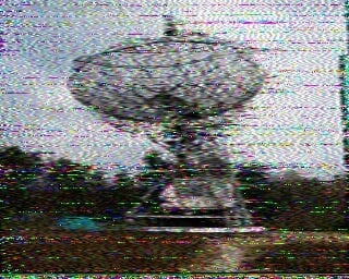
Meteor M N2-2 Successfully Launched: Awaiting LRPT Signal

On July 5 the Russian Meteor M N2-2 weather satellite was successfully launched into orbit and appears to be healthy. The LRPT weather camera signal is not yet broadcasting however, and we expect it to still take roughly 1-2 months before it begins (if all goes well) as satellites typically run through a long list of qualification tests before becoming operational. During this time there may be broadcasts of test patterns that can be caught. Meteor M N2-2 can currently be tracked in Orbitron and online at N2YO.

To try and dispel any confusion over the naming scheme, "Meteor M N2" is the currently operational LRPT satellite. "Meteor M N2-1" unfortunately failed in 2017 as it did not separate from the rocket. "Meteor M N2-2" is the new satellite which has just been successfully launched. Meteor M N2 and M N2-2 is often abbreviated as just "Meteor M2" and "Meteor M2-2". In the past there was Meteor M N1, but this satellite is no longer operational. We have upcoming launches for Meteor M2-3, M2-4, MP-1 and M3 to look forward to which are scheduled for 2020 and 2021.

Back on June 28 we posted about how Meteor M2 was experiencing orientation issues for a few days. Those issues appear to have been rectified now. Hopefully if M2 remains stable we'll have two Meteor LRPT weather satellites to receive alongside the three NOAA APT satellites.

If you're interested, there were also several other payloads onboard the rocket carrying M2-2, including a low cost Czech experimental cubesat called Lucky7 whose telemetry can be received in the amateur radio band at 437.525 MHz. There is an onboard camera too, but no details on how to receive it yet.

Soyuz Rocket carrying Meteor M2-2 Launched successfully. [Source: spaceflightnow]

Solar Sail Satellite Lightsail-2 Now Transmitting Morse Code Beacon

Lightsail-2 is a solar sail experiment which successfully launched on a Space-X Falcon Heavy on 25 June, and was released into orbit on July 2nd. A solar sail is a type of spacecraft that uses a large metallic foil to create propulsion via photons from the sun hitting it. Lightsail-2 is still undergoing testing, so it has not yet deployed it's solar sail, but recent updates indicate that it is healthy.

On board Lightsail-2 is a radio which is transmitting it's morse code beacon "WM9XPA" every 45 seconds at 437.025 MHz. This beacon should be able to be received with a handheld amateur radio 70cm Yagi and any radio such as an RTL-SDR. There is also an AX.25 telemetry data transmission, however although the beacon structure is available we are not aware of any publicly available decoding software.

One difficulty in receiving Lightsail-2 is that it is in an orbit inclination of only 24 degrees. So only locations with a latitude between 42 and -42 degrees will have a chance at receiving it. You can see the solar sail's current location at N2YO. Clicking on the 10-day predictions button will give you pass predictions for your location.

Estimated Lightsail-2 Viewing Range
Lightsail-2 Deployed

SignalsEverywhere: Investigating USGS Gaging Stations and their GOES Satellite Connection

The United States Geological Service maintains over 8500 "Gaging stations" in bodies of water all over the country. Gaging stations are devices that are used to measure environmental data such as groundwater levels, discharge, water chemistry, and water temperature. What's interesting is that they all upload their data in real time to GOES satellites - the same satellites that we can use with an RTL-SDR to receive weather images of the entire earth. The data is then downlinked in the L-band to the USGS scientists via a protocol known as DCP (Data Collection Platform).

In the latest SignalsEverywhere video, Corrosive investigates how these stations work, and how we can receive the downlink at 1.68 GHz with a simple Inmarsat L-band antenna. While a fully functional decoder is not yet available, Corrosive notes that one called goes-dcs is currently being worked on.

USGS Gaging Station | Satellite Uplink to GOES and DCP Messages