Tagged: drones

FliteGrid: A Crowdsourced Drone Detection Network That Pays Feeders US$50 A Month

Thank you, Chris, for writing in and sharing news about the recent launch of FliteGrid's hex claiming scheme. FlightGrid is a crowdsourced drone-tracking network that will pay feeders in an eligible hex grid $50 a month to run a drone-detection sensor. Chris explains:

The US government is building out Unmanned Traffic Management (UTM), which will be the equivalent of air traffic control for drones. This will make it possible to automate things like shipping, emergency response, infrastructure inspections, and more all over the country. To do that, they'll need awareness of every drone in the sky just like they have for every plane today, and FliteGrid is our solution to providing it.

The devices themselves are custom sensors that receive Remote ID transmissions. That's the standard the FAA created for drones to transmit identifying information, which it now requires all drones in America to broadcast. Serial number, location, altitude, operator location, etc. Remote ID can be broadcast on four different protocols, so we've got four receivers in each piece of hardware; two WiFi and two Bluetooth. That data is then uploaded onto the SkySafe platform, which provides a realtime map of every drone in the sky.

The catch to getting paid is that you need to 1) pay a $100 refundable deposit to receive their hardware, and 2) place and run it in a hex grid that offers to pay. The paying hex grids are mostly around US airports and critical infrastructure right now, so you'd need to live in, or have access to a roof in those areas to host the device. Payment is given in USDC, a stablecoin cryptocurrency pegged to the US dollar.
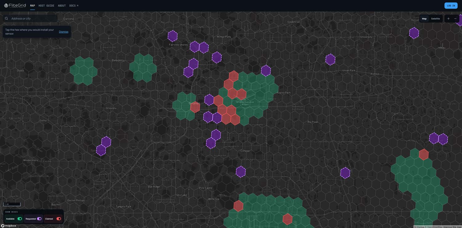
FliteGrid Hexes: Red - Claimed, Green - Available to claim with $50 p/m payout, Purple - Requested by community, Black - Requestable.

FliteGrid/SkySafe is able to pay users because operators of critical infrastructure and large facilities such as airports, universities, energy infrastructure, the US military, DHS, and the DOD will pay for real-time awareness of the airspace above them. SkySafe has been around since 2015, has raised around $50M in funding, and has contracts with many of the previously listed organizations. Chris notes that the service has already been used successfully in operations like busting gangs smuggling drugs into prisons via drones. 

The FliteGrid sensor appears to be a computing device with WiFi and Bluetooth radios repurposed to detect Remote ID, with each radio connected to a higher-gain external antenna. Recently, on the blog, we have seen DIY Remote ID detectors made from ESP32s and other commodity Bluetooth hardware.

Since a 2024 mandate, drones over 249 g in the USA must transmit Remote ID signals for tracking and identification purposes, similar to how ADS-B is used for larger aircraft. For ADS-B, flight aggregation services such as FlightAware/FlightRadar24/ADS-B Exchange etc. already exist, with volunteer feeders setting up stations that can cover up to 400km. However, unlike ADS-B, Remote ID is transmitted with single-digit milliwatts of power, compared to a minimum of 70W for ADS-B, so its reception range is limited, making a dense distributed reception network like SkySafe for Remote ID very important. Individual SkySafe hex grids cover just under 1km of area. 

FliteGrid cannot detect drones that are not transmitting Remote ID, though Chris mentions that government infrastructure and facilities may use normal radar to detect these. A radar detection that does not correlate with a SkySafe detection would confirm that a drone is a potential threat.
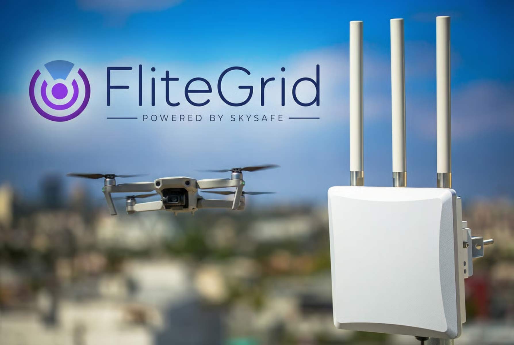

The FliteGrid Sensor

A Portable RTL-SDR and Raspberry Pi Based ADS-B Alarm for Drone Pilots

Pilots of RC planes and drones need to be aware of the area they are flying in, to make sure that they stay well out of the path of manned aircraft. However, this can sometimes be difficult with aircraft like police helicopters that could rapidly show up anywhere. Drones typically do not have ADS-B transmitters due to size/weight and price, but it is still possible for drone pilots to use ADS-B receivers to make their flying safer.

Over on YouTube user xjet has come up with a solution involving the use of a portable ADS-B alarm for drone pilots. The ADS-B receiver consists of a 3D printed enclosure containing a Raspberry Pi Zero 2W, LCD screen and an RTL-SDR dongle connected to an ADS-B whip antenna. xjet notes that when his code and 3D enclosure are finalized, he will release the design for free as open source over on http://www.rcmodelreviews.com.

The idea behind the ADS-B alarm appears to be that drone pilots will receive an alarm when they are within the vicinity of an aircraft. Assuming the drone is not too far away from the pilot (as rules specify drones must be flown within visible distance) the alarm being next to the drone pilot should be sufficient. xjet notes that we cannot rely on live ADS-B aggregation websites like FlightRadar24 due to their censorship of certain aircraft like police, military and some private jets, or due to possible lack of coverage, so a local receiver will be a better solution.

After more than two years of development and testing the ADSB alarm for RC plane and drone flyers is almost ready to go. I will be posting the full build details including an SD-Card image, source code, wiring diagrams and STL/DWG files for the case to the RCModelReviews website in the next week or so. This is a totally open-source project which I give freely to the hobby community so as to increase the levels of safety associated with our activities.

It is through the use of this technology that we can show how taking practical steps towards ensuring safety is every bit as important (if not more so) than blindly following regulations written by those who have probably never even flown an RC plane or drone themselves.

This changes everything (I'm not kidding!)

Decoding 5GHz NTSC Video from Drones with a HackRF, DragonOS and SigDigger

Over on his YouTube channel Aaron has uploaded a video showing how we can SigDigger to decode analog NTSC video from a drone camera which is transmitted at 5.7 GHz. SigDigger is a rapidly evolving SDR program for Linux and MacOS that has a lot of built in functionality for inspecting signals in more depth. Although not specifically designed for it, the Symbol Stream viewer in SigDigger can be used to display NTSC Analog Video. Aaron writes:

For the most part, the older an analog modulation is, the easier it is to get basic results when decoding. TV receivers were rather dumb back in the day, basically fast fax machines glued to an off-band FM radio receiver. Receiver circuits were also slow, and the signal had lots of invisible blank spaces in the borders so that the cheapest TVs could switch to the next line in time. The invention of Teletext leveraged those blanks in order to carry digital information and color information was embedded as an additional narrowband signal in the gaps in the spectrum.With this in mind I wanted to take a look at decoding analog video transmissions from drones. While some drones have moved to more effective digital compression and channel transmission technologies allowing for high definition video, there’s still drones using RC-like communications and the FPV video link is pure FM-modulated NTSC.

Searching the internet provided few results on how I could go about using low cost equipment, such as the HackRF One, to decode drone feeds. After an extensive search I decided to start looking at Linux based software defined radio applications I was already familiar with. By chance I happened to be working with SigDigger, a free digital signal analyzer. It has been discussed on RTL-SDR.com and more recently on Signal Lounge (https://signal-lounge.com/2020/05/05/sigdigger-for-signal-analysis/). It is also included in my own creation, DragonOS (https://sourceforge.net/projects/dragonos-lts/)

After a brief email exchange with the developer it was brought to my attention that visualizing analog video transmission is possible in SigDigger (although with no color information, of course). Since SigDigger supports the HackRF and the HackRF provides coverage in the 5ghz band, it was now possible for me to try to decode a 5ghz drone video feed. I’ve documented the process and my results on my YouTube channel. I should point out that this is currently a side feature of SigDigger and currently lacks synchronization. The symbol view area I used in the video is not made for this. It is meant to display symbols and symbols patterns which, due to its behavior, can incidentally show the contents of analog TV and weather faxes with lots of manual adjustments.

While the SigDigger developer makes mention of plans to include an embedded generic analog TV viewer and possibly add the ability to automatically sync video, there’s currently no timeframe on when that might become available.

SigDigger Decoding NTSC Video from a Drone Camera
DragonOS LTS SigDigger demodulating a 5 GHz analog video/FPV drone link (HackRF One, SigDigger)

We note that if you're interested in PAL/NTSC decoding, there is also the excellent TVSharp plugin for SDR# available.

Tracking Tagged Orangutans in the Bornean Jungle with Drones, GNU Radio and an Airspy Mini

Due to various human activities causing the environmental destruction of it's habitat, the Orangutan is now classed as a critically endangered species. In addition to being endangered, Orangutans face another problem in that they are often captured and sold as pets due to their intelligence and cuteness.

To combat these problems, NGOs, charities and rescue centers have been using RF tags on rehabilitated Orangutans that have released back into the wild. The RF tag regularly transmits a data-less pulse at VHF frequencies which is then typically tracked using direction finding equipment such as a directional Yagi antenna. The range is only approximately 200-400m. 

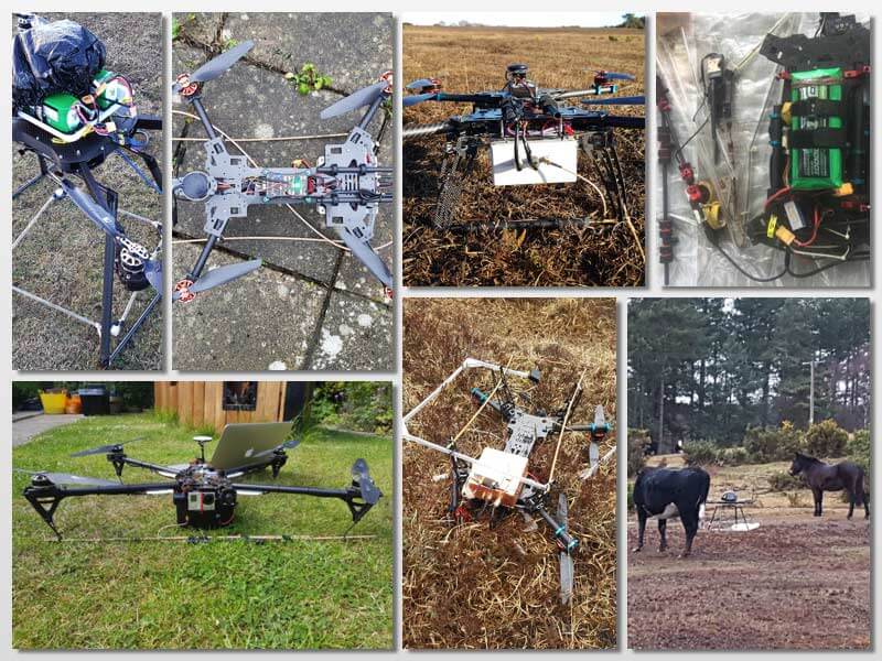
In order to try and alleviate the range issue Dirk Gorissen has been working on creating a drone based system that could detect the VHF transmission and create a heatmap of Orangutan positions. The first iteration of his system uses an RTL-SDR, Odroid and lightweight loop antenna. A simple Python script then monitors the spectrum and logs the drones current location, altitude, speed and heading when a pulse is detected. Tests confirmed that the signal was able to be detected from the sky, but unfortunately the drone was eventually crashed and lost before it could be properly used.

In his second try a few years later, Dirk used a larger drone and switched SDRs to an Airspy Mini with preamp. The pulse detection code was also improved by using GNU Radio to create a DSP algorithm combining peak detection, cross correlation with a known template of the signal, and a phase locked loop. Visualization and data transfer is achieved through react.js and a Flask web server running on the drones WiFi hotspot. This time with the new drone and system Dirk was able to successfully detect and locate several Orangutan's on various flights, despite noting that some RF tags appeared to be glitchy.

Orangutan Detected with Drone, Airspy Mini and GNU Radio.
Drone used in the experiment