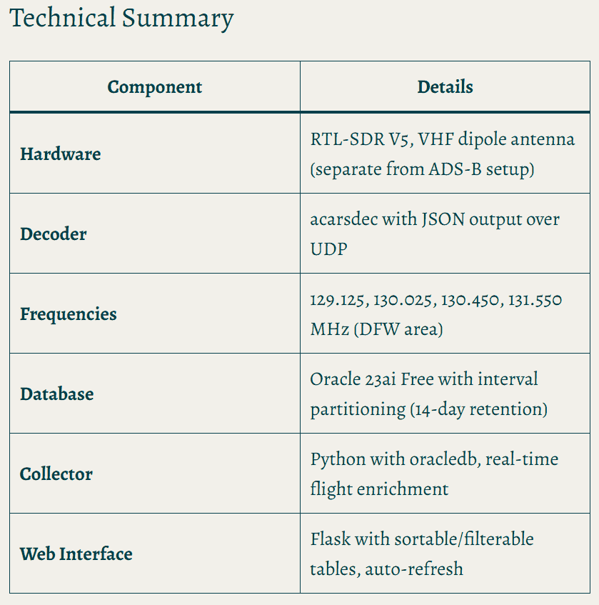
Over on his blog, cynicalGSD has written a detailed post about how he extended his home ADS-B flight tracking setup to also decode ACARS. His existing system runs an RTL-SDR dongle on a Raspberry Pi feeding a database and Flask web app. Adding ACARS required a second RTL-SDR and a separate VHF dipole antenna tuned for 129–131 MHz.
ACARS (Aircraft Communications Addressing and Reporting System) is a text-based datalink that has been in use since 1978, carrying short messages between aircraft and ground stations. It includes messages such as OOOI events (Out of gate, Off ground, On ground, Into gate), pilot weather reports, maintenance fault codes, and gate and fuel data. The key feature of their implementation is cross-referencing ACARS messages with existing ADS-B records via aircraft registration and ICAO hex address, enriching flight records with precise departure and arrival timestamps from the airline's own reporting system.
The full write-up covers the database schema, Python integration using acarsdec, gain tuning tips, and the Flask web interface. cynicalGSD mentions that the code is available for anyone interested, but we didn't see a link, so please comment on his post if you are interested.
Technical Summary of cynicalGSD's ACARS + ADS-B implementation.
Thank you to Cameron from BlackAtlas LLC for submitting their project GridDown, which is an open source Android tablet-based situational awareness system designed to operate without an internet connection. At its core, it appears to be a tablet with custom software, and then you can add sensors such as an RTL-SDR for ADS-B+Remote ID, a SARSAT receiver, and a Meshtastic ESP32-S3+SX1262 device. A demonstration of the UI can be found at https://griddown.blackatlas.tech.
Cameron writes:
[GridDown is] an offline-first situational awareness platform built for emergency preparedness, field response, and tactical operations in infrastructure-degraded environments — designed to work when cell towers are down, internet is unavailable, and operators are fully off-grid.
The platform is a Progressive Web App (~120,000 lines of vanilla JavaScript, no frameworks) that runs on Samsung Galaxy tablets, laptops/PCs, and works completely offline after initial setup. It's built by BlackAtlas LLC and is available for trial at https://griddown.blackatlas.tech.
The system has many facets to it, including:
Encrypted voice and text messaging via an ESP32-S3 with SX1262 LoRa transceiver
Passive RF sensing with the ESP32-S3 and SX1262.
Three passive drone detection methods: WiFi fingerprinting, FAA Remote ID reception, and 900 MHz control/telemetry link detection
Automatic gunshot detection via a ES7210 quad-channel I2S microphone on the ESP32-S3.
Automatic RF jamming detection
SARSAT beacon receiver
SSTV Encode/Decode
Meshtastic integration
APRS via Bluetooth TNC
ADS-B reception
RadioCode gamma spectrometer integration
Offline maps
ADS-B detection is handled by a Raspberry Pi 5 running an RTL-SDR Blog V4 dongle. Cameron writes:
The Pi connects to the tablet's built-in WiFi hotspot (no internet required — the hotspot functions as a local network only), and a Node.js bridge reads aircraft data from readsb and subscribes to the Remote ID receiver's MQTT output, then serves a unified WebSocket and REST API to the tablet. GridDown renders aircraft and drone tracks as heading-rotated silhouette icons on its offline map with altitude labels, age-based alpha fade, and emergency squawk alerting (7500/7600/7700). A 10,000 mAh USB-C PD battery provides approximately 5 hours of field runtime for the Pi.
The full setup script, hub bridge, and hotspot connection scripts ship with the project.
The software is dual-licensed, with it being open source GPL v3 (note that the GitHub link appears to be broken - we have asked for clarification) for non-commercial use, or a commercial licence for hardware bundles and business deployments.
Alternatively, BlackAtlas LLC is selling ready-to-use kits, with the core tablet coming in at $799. Other bundles include the Tablet + SARSAT receiver for $1,299, the Tablet + Meshtastic bundle for $1,299, and the Tablet + ADS-B/Remote ID bundle for $1,999.
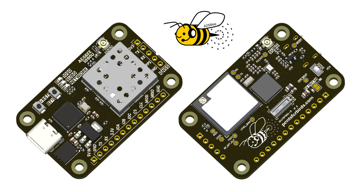
ADSBee is an open-source project that has implemented a 1090 MHz ADS-B decoder on a Raspberry Pi RP2040 microcontroller using a programmable I/O (PIO) pin.
PIO pins cannot handle RF signals, so the ADSBee front end is a critical analog circuit that enables this to work. It consists of a 1090 MHz SAW filter to remove other signals, a low-noise amplifier, and, critically, a log-power detector, which essentially converts the pulse-position-modulated 1090 MHz ADS-B signal to baseband, which the PIO can handle.
However, this same trick does not work for 978 MHz UAT, as UAT signals are not pulse position modulation like ADS-B. Instead, for UAT support, the ADSBee design takes a more traditional approach, using a CC1312 sub-GHz transceiver chip connected to the RP2040.
Finally, an ESP32 S3 is added to the stack to enable networking via WiFi, allowing for received and decoded data to be used.
The project is entirely open source on their GitHub, apart from some of their commercial PCB designs. They also have a store, where they sell pre-made kits. A kit consisting of the ADSBee, 1090 MHz Antenna, and 978 MHz costs US$152in total. They are also selling an industrial model for $995, which includes PoE power.
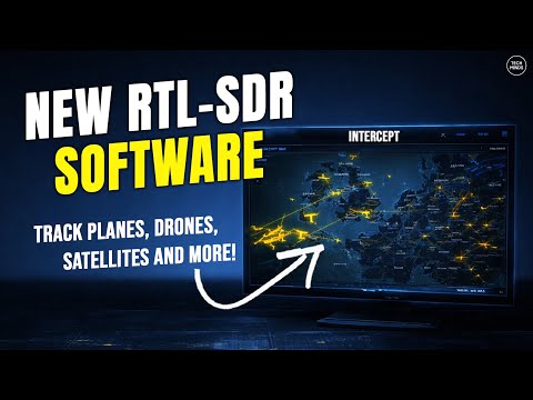
Over on the Tech Minds YouTube channel, Matt has uploaded a video where he tests out 'Intercept', a new tool for RF signals intelligence with RTL-SDRs and other wireless devices. It is open source with code available on GitHub and can be installed on Linux and OSX devices.
Intercept is a tool that combines multiple external decoder tools into one easy-to-access web interface. It is capable of the following:
Pager Decoding - POCSAG/FLEX via rtl_fm + multimon-ng
433MHz Sensors - Weather stations, TPMS, IoT devices via rtl_433
Aircraft Tracking - ADS-B via dump1090 with real-time map and radar
Listening Post - Frequency scanner with audio monitoring
Satellite Tracking - Pass prediction using TLE data
WiFi Scanning - Monitor mode reconnaissance via aircrack-ng
Bluetooth Scanning - Device discovery and tracker detection
We note that features like WiFi and Bluetooth scanning will require a separate WiFi and Bluetooth adapter to be connected. In terms of supported SDR hardware, Intercept supports RTL-SDRs, as well as any SDR supported by SoapySDR.
In the video Matt shows how to install Intercept, and shows it decoding data from the various supported signal types.
Intercept Radio Signals For Intelligence Gathering With An RTL SDR
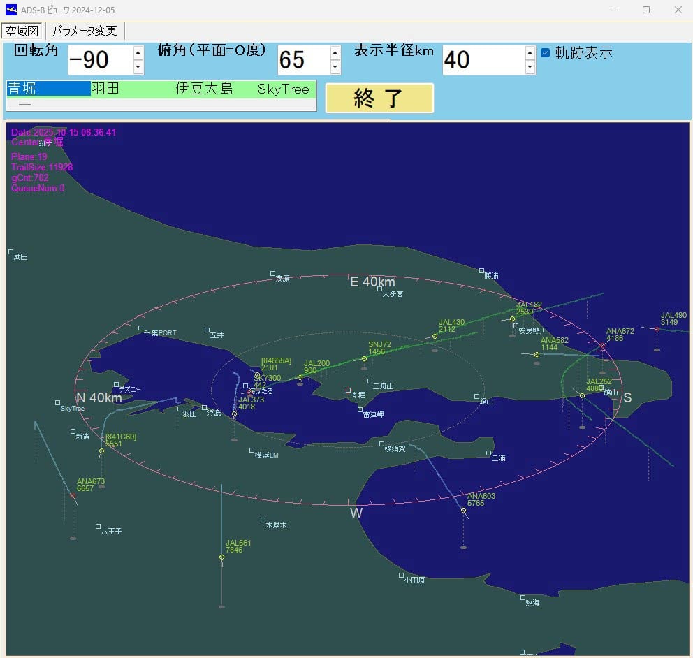
Thank you to Kazuya for submitting an aircraft tracking app that he's created for use with RTL-SDR dongles and dump1090. The program currently exists only as Visual C++ code and is documented in Japanese, so it may be somewhat niche and intended for advanced users to try out. Kazuya writes:
I live near Tokyo Bay, so I enjoy watching the takeoffs and landings at Haneda Airport.
The unique feature of this app is that it visualizes the descent angle, which is difficult to see on a flat map.
This app has not been available for distribution. If you are an intermediate Visual C++ user, you may be able to rebuild or modify the app.
Topographical and landmark information is in text files, allowing you to customize area information in more detail for your airport.
----
(3) Glide_Path Can be built independently.
Execution Environment Copy the folder (ADS_GLIDE_PATH) to C:.
・When using an ADS antenna Install the ADSB antenna and driver software on your PC. (As a mid-way test, you will be able to listen to radio broadcasts on your PC.) Launch dump1090_with_StdinAPL1.bat to ensure that tmp_ADS_B-0000****.txt is continually generated in C:\ADS_GLIDE_PATH\tmpDataFolder.
- Without an ADSB antenna You can use the data in DemoData (approximately 30 minutes, 6,000 entries) to check the software's operation. (Procedure) Launch Glide_Path.exe and, on the parameter change screen, set [S001] Demo Mode to 1. Exit Glide_Path.exe and restart it. The Start Demo button will appear; press it.
(4) Stdin_Apl1 Can be built independently. This is an auxiliary program when using the ADS antenna described above in (3). Stdin_Apl1.exe This program parses the standard output of dump1090.exe, provided by the ADS antenna manufacturer, into a text file and processes the data so that it can be read by Glide_Path.exe.
Thank you to Nagy István for sharing with us his setup for decoding ADS-C with a 180cm prime focus dish, a cheap Aliexpress LNB, an Aliexpress bias tee, and an SDRplay RSP1B.
István receives the ADS-C signal from the Inmarsat 4A-F4 satellite, which he can see from his home in Hungary.
István also notes the following information about the Chinese LNB:
This LNB original for DVB reception, but it works on Inmarsat reception, 3.6Ghz where ADS-C signals are, without any modification... But sometimes you need correcting frequency because of LNB oscillator drifting. I don't use dielectric plate, I don't have any material for this, at the moment.
Compared to ADS-B, which continuously broadcasts an aircraft’s GPS position and velocity to any ground station or nearby aircraft, ADS-C instead sends position reports via satellite, and is especially used over oceans and remote areas without ADS-B ground receivers.
However, ADS-C is relatively complex for hobbyists to receive due to the need for a large satellite dish and LNB to convert the 3.6 GHz frequency down to a frequency receivable by most SDRs. However, fortunately, as István shows, the LNB can be obtained cheaply these days.
Inmarsat ADS-C decoding with Jaero and Virtual Radar
ADS-C Being Received with an 1.8m dish, cheap Aliexpress LNB and SDRplay RSP1B.
In his latest YouTube video, Gabe from the saveitforparts channel has uploaded an interesting video detailing how he's tracking government spy planes over his neighbourhood using SDRs to monitor ADS-B data, and Orbic hotspots to detect Stingray activity (fake cell tower basestations).
In the video, Gabe highlights how he detects and follows a suspicious aircraft, concluding that it is most likely a DEA surveillance plane. This conclusion is supported by the fact that the ADS-B data is censored on FlightRadar24, something which normally only happens with law enforcement aircraft, as well as private jets. Upon zooming in on the aircraft with a camera, various antennas and cameras are also visible on the belly. Finally, Gabe found that the plane's registration number is linked to a Texas-based shell company with connections to the DEA.
In the video Gabe also tests out the RayHunter custom firmware for Orbic mobile internet to WiFi hotspot devices. This custom firmware turns these devices into Stingray detectors. A Stingray is a fake cellular base station that is often used by law enforcement to spy on cell phone activity.
Is That Really A Government Spy Plane Over My Neighborhood?
Thank you to Paul Maine for writing in and letting us know about his YouTube video showing how to set up ADS-B reception with an RTL-SDR, dump1090, and Virtual Radar Server on a Windows machine. ADS-B reception is a common project for RTL-SDR users; however, as Paul notes, most of the video tutorials available on YouTube are outdated.
Paul has also been uploading other videos to his YouTube channel recently, including tutorials on GNU Radio and setting up rtl_433, so check it out if you are interested.
E11 Tracking Airplanes using RTLSDR with Virtual Radar and ADS-B