At the beginning of this month, we posted about SkyRoof, a new software program by VE3NEA for receiving and tracking ham radio satellites with an RTL-SDR and other SDRs.
Recently, Matt from the TechMinds channel uploaded a video on YouTube testing out SkyRoof. In the video, Matt explains the software's various sections and features, such as Doppler correction. He then goes on to demonstrate various audio voice signals being received with the software.
SkyRoof - A Brand New Satellite Tracking Software With Built In SDR Software - This is awesome!
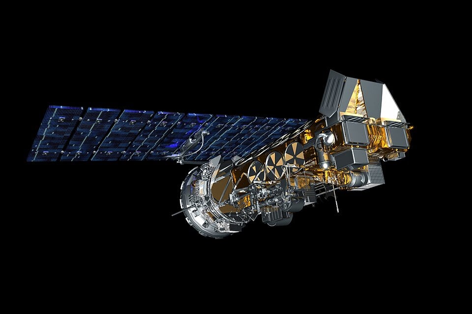
A few days ago, we posted news that NOAA-18 was to begin decommissioning steps effective immediately due to a recent transmitter failure. Multiple reports have now confirmed that NOAA-18 has indeed shut down as of 1740 UTC 06/06/2025.
Recently VE3NEA has released a new Windows program called "SkyRoof". SkyRoof is both a satellite tracking and SDR receiver program. It supports the RTL-SDR as well as Airspy and SDRplay devices.
The software is designed for tracking and receiving ham radio satellites, and it can provide detailed information about all ham satellites, tracking them in real time, and provide pass prediction. It also shows a skymap and SDR waterfall display. The receiver software supports demodulation of SSB/CW/FM, and it automatically compensates for doppler. It can also interface with antenna rotators that support hamlib.
SkyRoof Satellite Tracking and SDR Receiver Software Screenshot
Over on YouTube Johnson's Techworld has also recently uploaded a video showing him testing out Skyroof, which may be of interest to some.
Brief review of SkyRoof, the latest satellite tracking software!
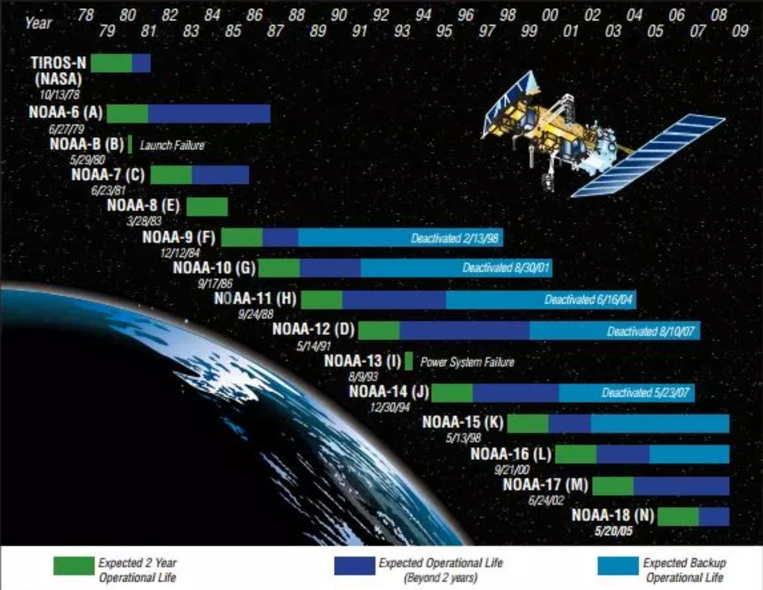
In April, we posted news that the NOAA satellites would be classed as 'end-of-life' on June 16, 2025. According to the statements, the satellites were expected to remain in orbit and continue transmitting data that radio hobbyists could use, but no attempts would be made to rectify failures.
NOAA-18 may have been chosen to be decommissioned earlier than NOAA-15 and NOAA-19 as the S-band downlink transmitter failed last month, resulting in severe image degradation. The satellite has also been running on backup gyros since 2017, and has suffered various transmitter and sensor failures over the years.
Lutz's blog post first describes and shows his RTL-SDR GOES reception setup. Then, it explains how he used Edge Impulse on his Raspberry Pi 4 to create an AI model that automatically detects the clouds in the image.
The process begins by importing 100 images into Edge Impulse, manually labelling the clouds in each image, training the model, and testing it. The result was an average detection accuracy of 90%.
NOAA satellite weather image APT transmissions have long been a staple of RTL-SDR hobbyists as they are among the easiest and cheapest satellite transmissions to receive. A simple V-dipole, RTL-SDR, and a computer are all that is required.
Sadly, it was recently announced that the NOAA satellites will be classified as end-of-life (EOL) on June 16 2025. However, the good news is that APT and HRPT data transmissions are expected to continue as usual. The end-of-life status indicates that NOAA will cease its own collection of data from these satellites and, hence, will no longer be distributing the datasets online. It also means that the satellites should no longer be used for mission-critical or scientific purposes and that no attempt will be made to fix a failing satellite.
These satellites have been operating well past their operational life, and given their advanced age, failure could come at any time. So the Open-Weather nowcast on June 15 2025 remains a nice way to honor their service to humanity.
In a recent video on the saveitforparts channel Gabe shows how he used a DIY radio telescope to take a video of geosynchronous TV satellites. The system works by using a motorized dish to scan the sky at Ku-band frequencies. An SDR is used to receive the signal strength at each dish position, and this data is used to create a heatmap image.
Each scan takes an hour to scan the sky, but by running a scan every hour, Gabe is able to create a video of the geosynchronous satellites wobbling. While still mostly fixed at one position in the sky, unlike geostationary satellites, geosynchronous satellites can appear to move in a figure-eight pattern from the ground, and this wobbly movement is apparent from Gabe's video.
The video also shows the sun passing by every 24 hours as the sun emits some RF energy in the Ku-band, as well as brief blips from Starlink satellites. The video also shows the effect of rain fade, as Gabe shows how the heatmap power was attenuated during poor weather.
Videos Of Satellites In Space Made With DIY Radio Telescope
Over on the USradioguy.com blog, we've seen news from Carl Reinmann noting that NOAA 15, 18, and 19 will be classed as end-of-life on June 16, 2025. These NOAA satellites are ones commonly used by RTL-SDR hobbyists to download weather satellite images, either via APT on 137 MHz with a V-dipole antenna, or via HRPT on 1.7 GHz with a tracking dish antenna.
Initially, it was thought that this meant that transmissions would cease. However, Carl Reinmann has now clarified with NOAA that transmissions of the APT and HRPT signals will continue as usual. Importantly, NOAA urges that these transmissions will only be "data of opportunity" and should no longer be used for operational purposes (not for anything safety-critical, for example). The transmissions will be fine for everyday hobbyist use.
However, this does mean that should the sensors on these satellites start failing, no attempt will be made to repair them from the ground, and in case of critical failures, the satellites will be decommissioned. In the past, we've seen NOAA 15's scan motor fail multiple times before coming back to life. It's not clear if the satellite received commands from the ground that helped recover it or if the motor just recovered by itself.
The NOAA satellites have lived well past their operational life.