Category: Satellite

Receiving SSTV From the Russian UmKA-1/RS40S Cubesat

YouTuber 'saveitforparts' was recently contacted by the ground controller of the Russian UmKA-1/RS40S cubesat asking if he'd like to try and receive an SSTV image from the satellite. UmKA-1/RS40S is a small educational satellite assembled by a Russian high school. Originally it was intended for a radio astronomy experiment, but due to technical issues it's been switched to the secondary ham radio mission only.

Saveitforparts uses an RTL-SDR, directional Yagu antenna, PC running the MMSSTV decoder, and Android phone running the Stellarium satellite tracking app. After a few failed attempts he was able to eventually successfully track and receive the SSTV image as well as some telemetry.

We note that the SSTV image appears to have been specifically scheduled for saveitforparts personally, so if you try to receive this satellite yourself you will probably only be able to receive the telemetry signal.
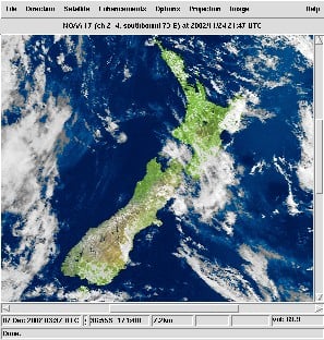
Receiving Targeted Message From Russian Satellite

Meteor M2-4 Successfully Deployed to Orbit and now Transmitting Weather Images

The long awaited Russian Meteor M2-4 satellite was successfully launched on February 29, 2024 and is now in orbit, and is already transmitting images. If you are unfamiliar with them, Meteor M satellites are a class of Russian weather satellites that can be easily received with an RTL-SDR and appropriate satellite antenna. The easiest transmission to receive is around 137 MHz, and to receive this signal a simple V-Dipole or more advanced QFH antenna can be used. It also transmits in the L-band, and a small 60cm+ dish can be used to receive it with motorized or hand tracking.

The video below is an archived live stream of the launch.

LIVE: Roscosmos Meteor-M 2-4 and others Mission Launch | Soyuz 2.1b/Fregat-M

Prior Meteor M class satellites have typically been plagued with various issues, but so far the launch and deployment of M2-4 appears to have gone very smoothly. Reports are that the signal strength is excellent (much better than M2-3 with it's suspected antenna deployment fault) and images have been received clearly on both VHF and L-band.

TLE's and SatDump have been updated to support Meteor M2-4, so if you want to receive the satellite be sure to update to the latest code on Github.

Over on X, Scott Tilley has posted an image he received recently on both bands.

IndiaRocketGirl Receives FengYun-2H S-VISSR Satellite Images

Over on her YouTube channel IndiaRocketGirl has posted a video showing how she was able to build a satellite dish and feed to receive FengYun-2H S-VISSR signals and get beautiful full disk images of the earth.

In the US and other countries RTL-SDR fans will be familiar with how to receive images from the GOES geostationary weather satellite. However from countries like India most GOES satellites will not be visible. Fortunately there are alternative satellites like the Chinese FengYun-2H satellite which is visible from India. FengYun-2H is a geostationary satellite that sends down a S-VISSR signal containing full disk images of the earth.

In her video IndiaRocketGirl uses a 1.8 meter diameter antenna, a homemade helical feed, an LNA+filter and an RTL-SDR as her hardware. For software she uses SatDump.

How to receive Real Time Images from Geostationary Satellites | RTL SDR | India Rocket Girl

WXCorrector: Updating Keplers for Linux users of WXtoIMG

Thank you to Hamdy Abou El Anein for submitting news about the release of his software called "WXCorrector".  

WXCorrector is a dedicated solution designed specifically for Linux users who face challenges with the handling of Kepler elements in Wxtoimg. This tool addresses a critical issue where incorrect or outdated Keplerian elements can cause disruptions in tracking software, leading to inaccurate predictions and potential data loss.

It work on Linux, it needs sudo rights and Python3 installed.

https://github.com/hamdyaea/wxcorrector-for-linux

WXtoIMG is a commonly used piece of software for decoding images from NOAA APT weather satellites. However,  WXtoIMG is now considered abandonware as the original website has gone, and the main author has not updated the program in many years. The latest versions from 2017 can be downloaded from Archive.org. An alternative download site is https://www.wraase.de/wxtoimg, where they also provide a way to update Keplers for Windows machines.

Due to it's abandonment, certain features like Kepler updates from the internet appear to have broken over time with changes to the way Kepler files are served. Up to date Kepler files are required for the software to know exactly where satellites are in the sky for tracking and scheduling.

A modern alternative to WXtoIMG is SatDump, which now supports NOAA APT satellites.

WXtoIMG

Spacewalker LNA 434 MHz In Prelaunch at CrowdSupply

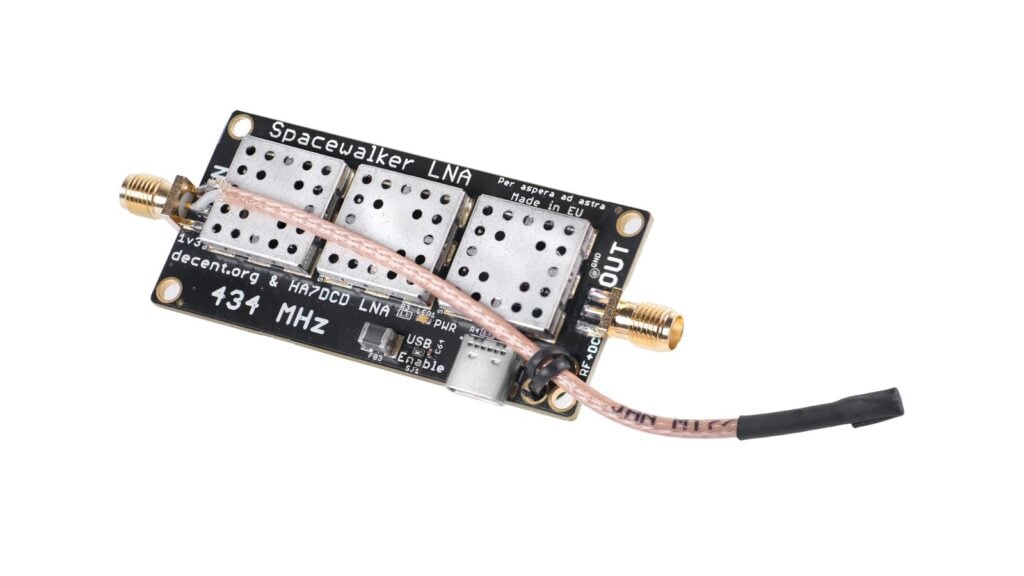
Thank you to Zoltan and team for submitting news of the prelaunch of their Spacewalker LNA 434 MHz. Spacewalker LNA is designed to improve reception of PocketSat and Cubesat satellite signals when received with SDR devices like the RTL-SDR. Often these relatively weak signals are drowned out by strong interfering terrestrial signals like DVB-T and GSM. To solve this the triple filter and dual amplification design used in the Spacewalker LNA can help to isolate the satellite signals.

The team write that prototype versions of the LNA are already successfully in use around the world with SatNOGS stations. The device uses two state of the art QPL9547 LNA with 0.2 dB noise figure and 25 dB gain at 434 MHz and three 434 MHz SAW filters. The design also uses an interesting coax stub for ESD protection. It can be powered with 5V USB-C or via bias tee.

The LNA is currently in the prelaunch stages with CrowdSupply, so it will likely be released for crowd funding within the next few months. If you are interested in being notified when the campaign launched, be sure to sign up on the Crowd Supply page for updates.

Spacewalker LNA 434 MHz. Designed for PocketSat and CubeSat signals amidst strong DVB-T, TETRA, FM, and LTE signals from densely packed transmitter towers.

SatDump V1.1.4 Released

SatDump is a popular program used to receive and decode images and other data from various weather satellites. SatDump works great RTL-SDR Blog dongles and with our Discovery Dish, an easy to use dish and feed for receiving L-band and other weather satellites. Recently the author of SatDump released version 1.1.4 which brings several new features including:

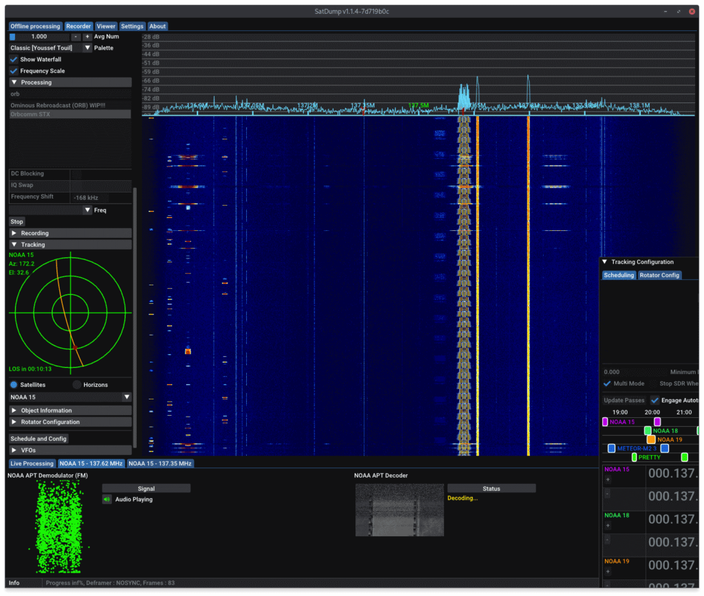
  • Autotrack/Scheduler improvements - multi mode has been added which allows all pipelines to run, even if more than one satellite is overhead at the same time. This is useful for NOAA and METEOR satellites at 137 MHz as there can often be more than one active satellite broadcasting images at different frequencies during a pass.
  • TUBIN Raw/Video Mode
  • ESA Cluster support
  • Additional Pipelines - Including Peregine X-Band TLM, the IM-1 Moon Mission and PRETTY S-band dump.
  • Themes - Choose between Dark, Light, Phosphor and Win98 themes.
  • Android Improvements - Blog V4 support added on Android, OpenCL support added.
  • Added composites - Various composite image products added to various satellites. Including Fog, panchromatic, ice detecting and more.
  • Other Features - support for M1 Mac builds added and various other fixes.
  • Bug Fixes - Memory leaks fixed and various bug fixes including a bug that caused problems with RTL-SDR devices on low power hardware like Raspberry Pi's and Orange Pi's.

If you enjoy SatDump consider donating to the main author at ko-fi.com/aang23.

SatDump Multi-Mode Feature. Receiving data from multiple 137 MHz satellites at the same time.

Multiple Comprehensive Tutorials on Weather Satellite Decoding

Over on his website "Jacopo's Lair" IU1QPR (@original_lego11) who is also a developer for SatDump has written up many tutorials about weather satellite decoding that involve the use of SatDump. SatDump is a popular piece of software often used with RTL-SDRs and other low cost SDRs for decoding weather satellite images.

With a small satellite dish, feed, RTL-SDR and LNA+filter and the SatDump software it's possible and download beautiful images of the earth from many geostationary and polar orbiting weather satellites. We note that we are currently taking pre-orders on Crowd Supply for our Discovery Dish system, which is low cost hardware designed to help users get started with weather satellite reception.

Over on Reddit IU1QPR has created a listed summary of all the tutorials he's written. These are currently the most up to date and comprehensive tutorials that we have found on this topic. The tutorials cover everything from what satellites are available, what dish sizes you need, what SDRs can be used, what LNA+filter and other hardware you need, and how to use the SatDump software.

Satellite reception and decoding

Automated stations

SatDump usage

All have been moved to SatDump's documentation page

Satellite data processing and usage

From the HRPT tutorial: What various HRPT signals look like on the spectrum.
From IU1QPR's HRPT tutorial: What various HRPT signals look like on the spectrum.

Downloading Stored Images and Data from the NOAA Weather Satellite GAC Broadcast

With polar orbiting weather satellite reception we as amateur ground station operators with SDR receivers typically download images via "Direct Broadcast", which provides imagery of what the satellite is currently seeing live. However, the main way satellites such as the NOAA POES (NOAA 15, 18 & 19) satellites downlink is via "Global Area Coverage" (GAC) broadcast which provides the full stored imagery data of the entire global pass. However, GAC is only broadcast in locations where the satellite operator operates ground stations.

Over on YouTube dereksgc has uploaded a video showing how to receive GAC data from the NOAA POES satellites. He notes that GAC is now broadcast at 2247.5 MHz in the S-band, and the ground station it now downlinks to is likely in Svalbard, rather than in the USA. This means that amateur satellite stations close to the North Pole can receive the GAC signal, including dereksgc's station which (we believe) is in the Czech Republic.

Dereksgc uses a large 250cm offset dish with S-band feed connecting to a HackRF. In the video he demonstrates him receiving the signal, and then decoding it using SatDump. Finally he shows all the images from various locations around the earth that he was able to receive from one satellite pass.

Downloading stored data from NOAA weather satellites (GAC revisited) || Satellite reception pt.12B