Information about Receiving the GOES-13 Weather Satellite (Europe Coverage with 1.8m Dish)
For some time now many weather satellite enthusiasts have enjoyed the ability to relatively easily receive live high resolution images directly from the GOES-16, GOES-17 and GK-2A geostationary satellites (tutorial here). However, while much of the world can see at least one of these satellites, European's have been left out.
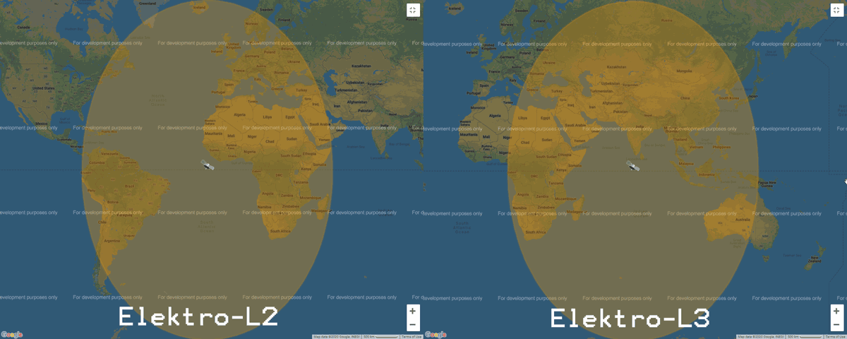
What may be of some interest to Europeans is that the older GOES-13 (aka EWS-G1) satellite was repositioned in February 2020, and it can now be received in Europe (as well as Africa, the Middle East, Asia, Russia and West Australia) until at least 2024 when it will be replaced.
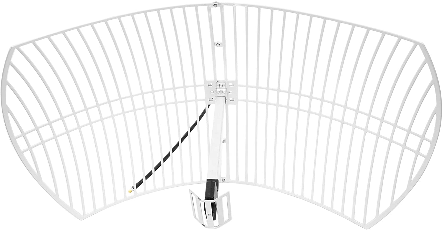
The important catch however is that GOES-13 is not broadcasting the same easy to receive LRIT/HRIT signals that the other satellites use. The signal is still in the L-Band at 1685.7 MHz, however it is called "GVAR" and it is much weaker and uses 5 MHz of bandwidth. For GOES 16/17 and GK-2A a 1m WiFi grid dish, LNA and RTL-SDR was sufficient, but for GOES-13 you'll need a much larger 1.8m dish, and a wider band SDR like an Airspy. The big dish requirement significantly increases the reception challenge.
We also note that the decoder is being developed by @aang254 and u/Xerbot and it is not yet publicly released. However, they do intend to release it soon. Update:
- u/Xerbots decoder: https://github.com/Xerbo/GVAR-Tools
- @aang254's Decoder: https://github.com/altillimity/GVAR-Ingestor
Over on his blog Carl Reinemann has been collecting some useful information about GOES-13 reception. Over on Reddit u/derekcz has also created a post with some useful information. We've also been talking to @ZSztanga in Poland who has been testing this satellite out, he wrote:
My hardware is: 180cm prime focus dish, with a custom cantenna (120mm diameter). I'm using the SAWBIRD GOES LNA. I will be switching to the + version, because the setup is still lacking a few db SNR. The SDR is the one I use for HRPT: the airspy mini
I found that the USB connection on the airspy generates a lot of noise, so I removed the USB cable, by moving the airspy to the laptop. I use 2m of CNT-400 coax and it works much better now. I get about 2 db SNR more. Thought you might find it interesting.

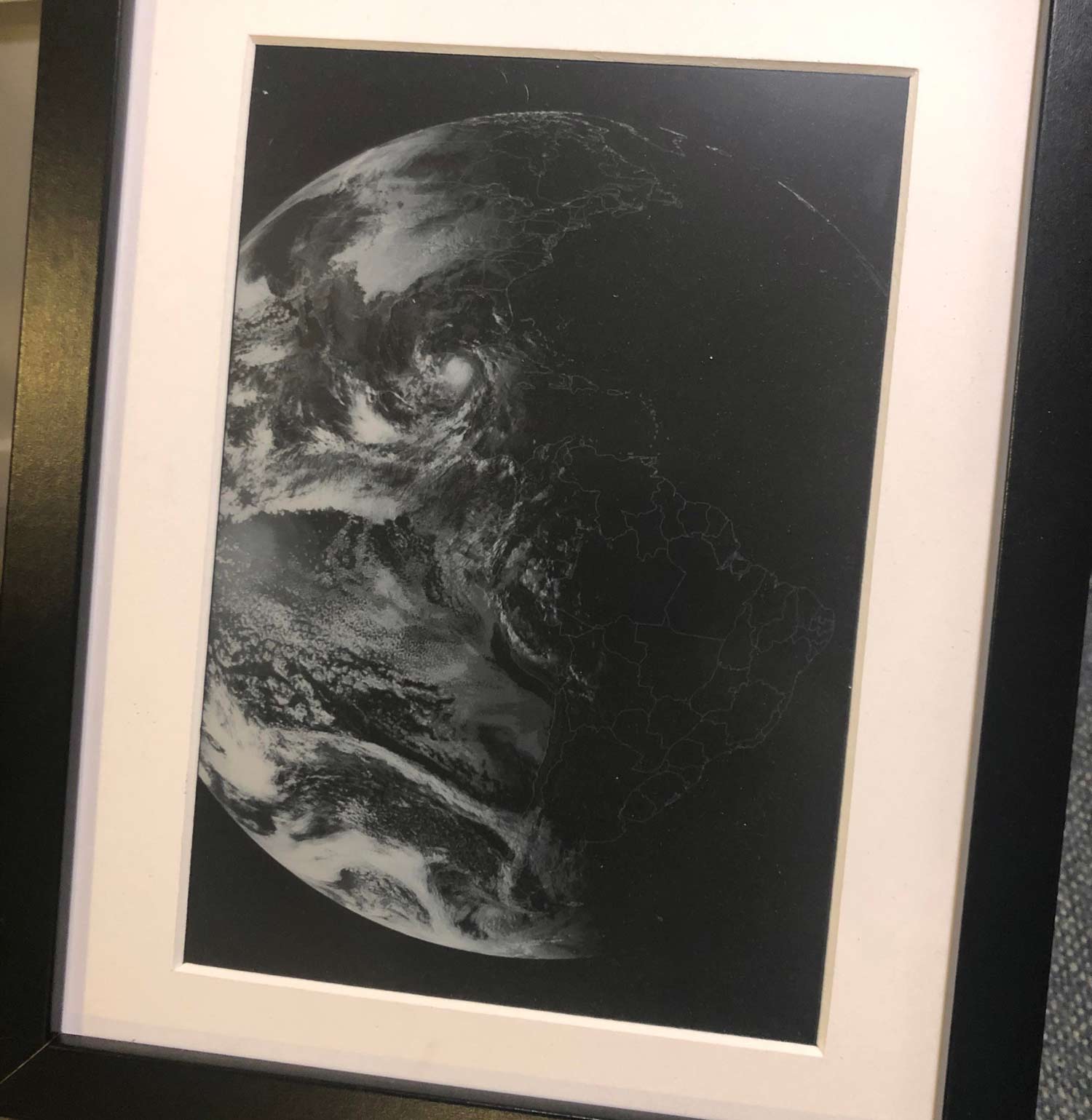
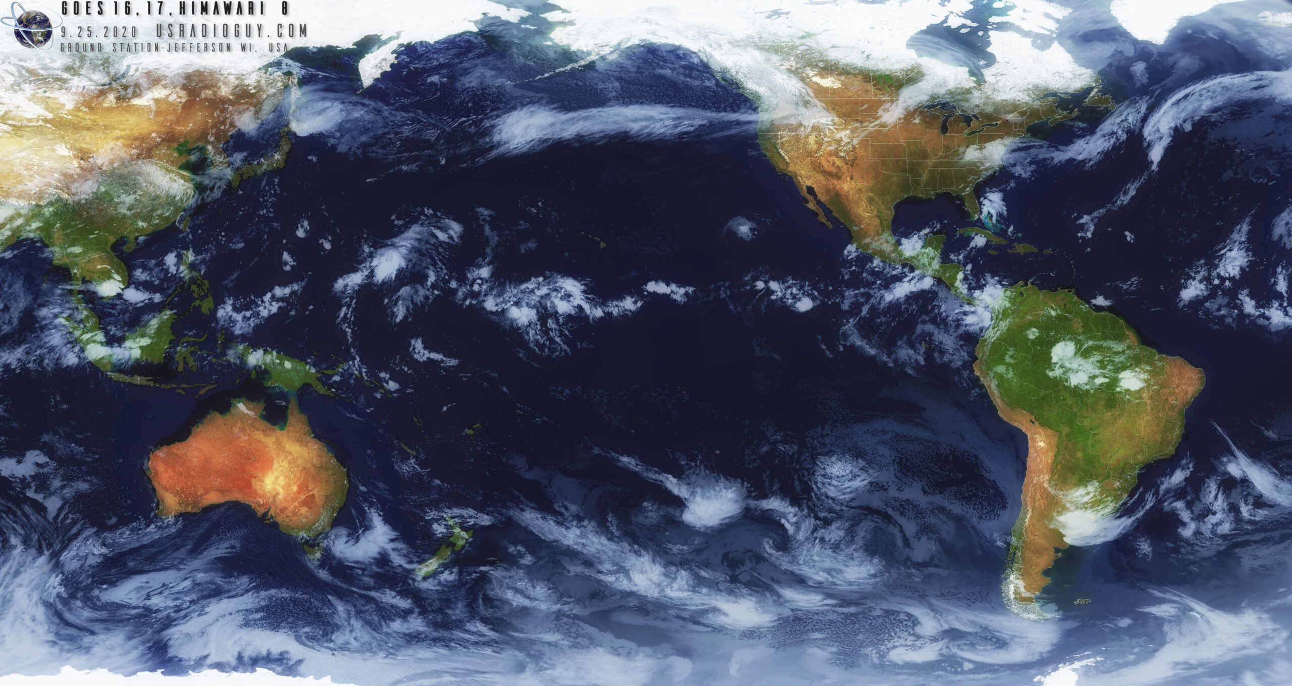
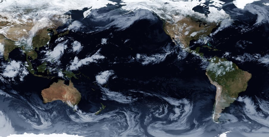
We note that there is some interesting differences with GOES-13 images. Since the image is less processed, it is higher resolution (a full resolution image can be found on this Reddit post), as well as not cropped, meaning that the Earth's atmosphere is visible. Please also follow @ZSztang on Twitter for more images.
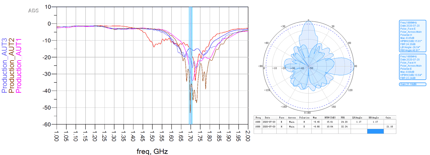
According to the newest calculations performed (by me) on the EWS-G1 data, it has a stunning resolution of about 0.6x1 km/px on the VIS channel and about 2.5x4 km/px on the IR channels. I have yet to confirm my calculations with the doc, which is quite hard to get. pic.twitter.com/kLK8YPDyTV
— Zbigniew Sztanga (@ZSztanga) November 12, 2020
What I really like about GOES-13 is that the data is unprocessed. That allows to see the atmosphere which is normally cut off on LRIT/HRIT. pic.twitter.com/BWJAVXFnUi
— Zbigniew Sztanga (@ZSztanga) November 7, 2020