Discovery Dish Now Available for Crowd Funding! A Lightweight Dish and Feed for L-Band Weather Satellites, Hydrogen Line and Inmarsat
Today our Crowd Funding campaign for the Discovery Dish has gone live! Thank you to anyone who supports this project and our goal of bringing affordable products that make getting into various radio projects easier.
Our launch announcement reads:
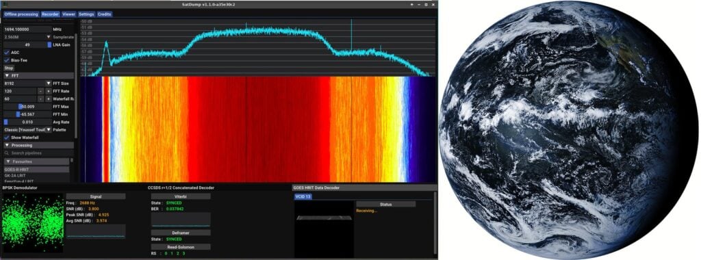
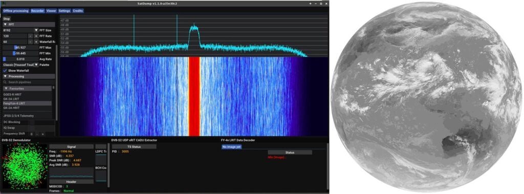
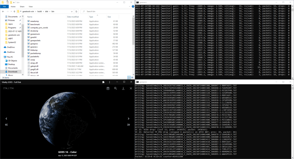
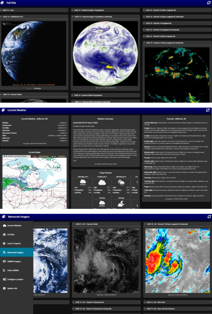
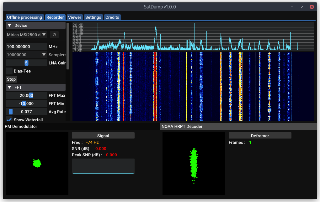
We decided to develop Discovery Dish because we were disappointed by the lack of ready-to-use, low-cost, lightweight dish antennas on the market that are suitable for software-defined radio projects like receiving L-Band geostationary and polar-orbiting weather satellites, as well as for 1.5 GHz Inmarsat reception and 1.42 GHz hydrogen line radio astronomy. With excellent open source weather satellite decoding software, like SatDump, now available, it’s time for a complementary, easy-to-use hardware solution.
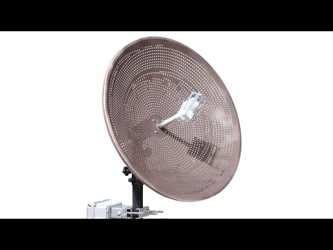
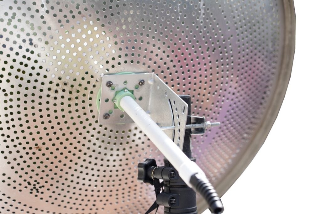
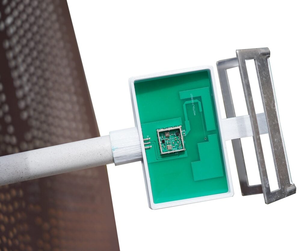
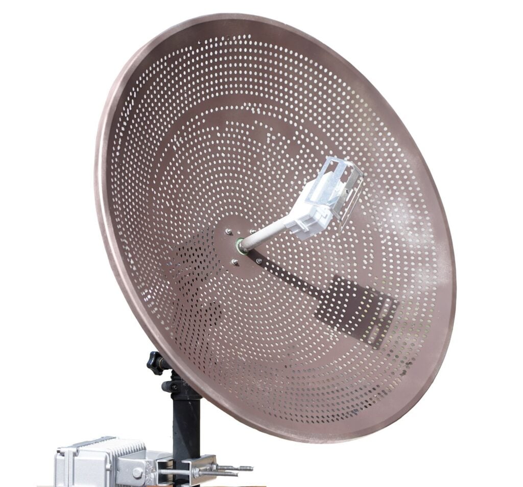
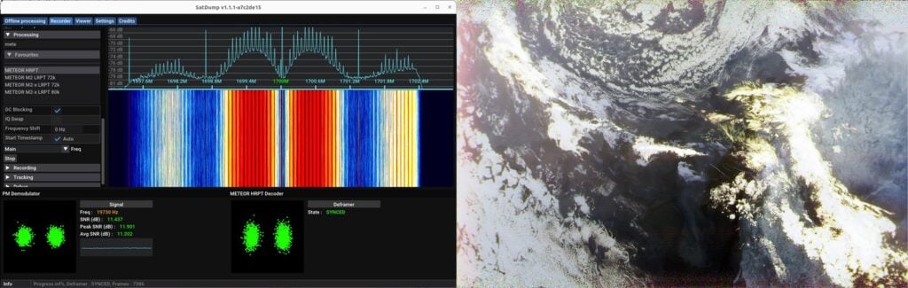
Through testing over several years, we chose 65 cm as the diameter, as we found that 60 cm is close to the minimum diameter required for perfect GOES weather satellite reception at 24° elevation, so this size should be suitable for most of the world that has GOES reception available. For LRPT satellites like GK-2A, and HRPT polar-orbiting satellites, it is more than large enough. We combined the dish with a carefully tuned feed that has a built-in low-noise amplifier (LNA) and dual filtering, which means there is no loss from feed to LNA. This also means we can use thinner and less stiff coax cable, which is a lot easier to handle and route. Finally we ensured that the entire dish and feed system is waterproof.
The only other ready-to-use dish offering we found is based on a modified 2.4 GHz grid Wi-Fi dish, which is still in our opinion too big and heavy. Size and weight is especially the important if you want to be able to use a low-cost, light-duty antenna rotator, which typically can only handle less than 1 kg in weight. We found that the grid Wi-Fi dish offering also has no solution for waterproofing the LNA, so the LNA needs to be placed indoors and very thick and unwieldy coax is used to avoid feed to LNA losses.
Other ways to receive these weather satellites and carry out hydrogen line experiments typically involve modifying a 2.4 GHz Wi-Fi grid antenna, or an old satellite TV dish. But these modifications can be time-consuming and difficult to get right, and even 60 cm satellite TV dishes are too heavy for light-duty antenna rotators.
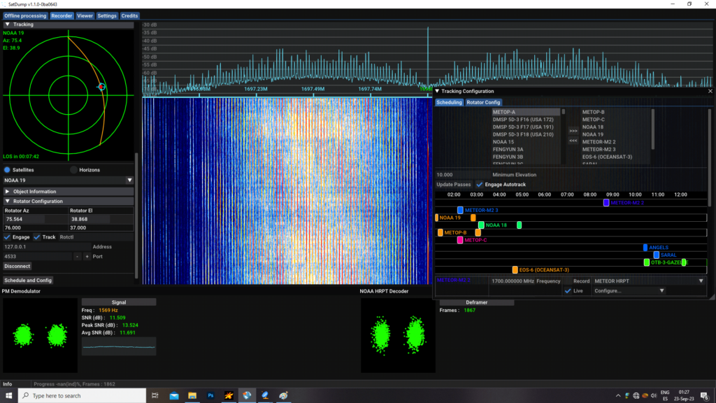
Finally, we developed Discovery Dish with an eye toward it being used with a low-cost antenna rotator, and we are in the process of prototyping our own rotator design. Our antenna rotator is not ready for crowdfunding yet, as there are still some things to work out and long-term stress testing to be done, but please keep an eye out for it in 2024! An antenna rotator is a great addition if you want to use a dish antenna to decode images from the polar-orbiting HRPT weather satellites.
Note that you don’t need an antenna rotator to receive geostationary satellites like GOES, or to do drift hydrogen line observations. For polar-orbiting HRPT satellites, the lightweight nature of Discovery Dish also makes tracking the satellites by hand a much easier prospect.
Learn more about Discovery Dish on our main campaign page. Thank you to everyone who supports the Discovery Dish project in any way!