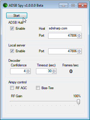
Youssef, the programmer of SDR#, has just released a beta version of an ADS-B decoder for the Airspy. The software is called "ADSB Spy" and is similar in operation to ADSB# which is used with the RTL-SDR dongle. The increased sensitivity and lower noise floor of the Airspy should help ADS-B enthusiasts get longer ranges and more aircraft on their screen.
Previously we posted about Will’s (aka hpux735) project [1][2] where he has been using an RTL-SDR dongle to help understand and decode aircraft navigation VOR signals. VOR is an acronym for VHF Omni Directional Radio Range and is an older method of navigation used by aircraft which is used to provide a heading towards a VOR transmitter.
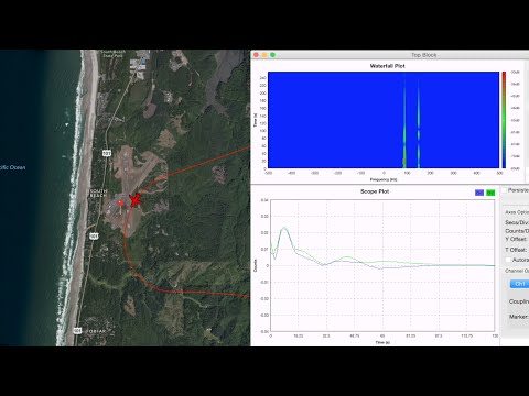
In his latest video, Will has been able to finish his code which allows him to actually plot some VOR data that he obtained from a flight on a map. In the video the VOR data is used to draw a heading line between three recorded VOR transmitters and the aircraft. The video clearly shows the accuracy of the VOR signals (about 1 degree) and shows what happens to the heading accuracy when reception is bad.
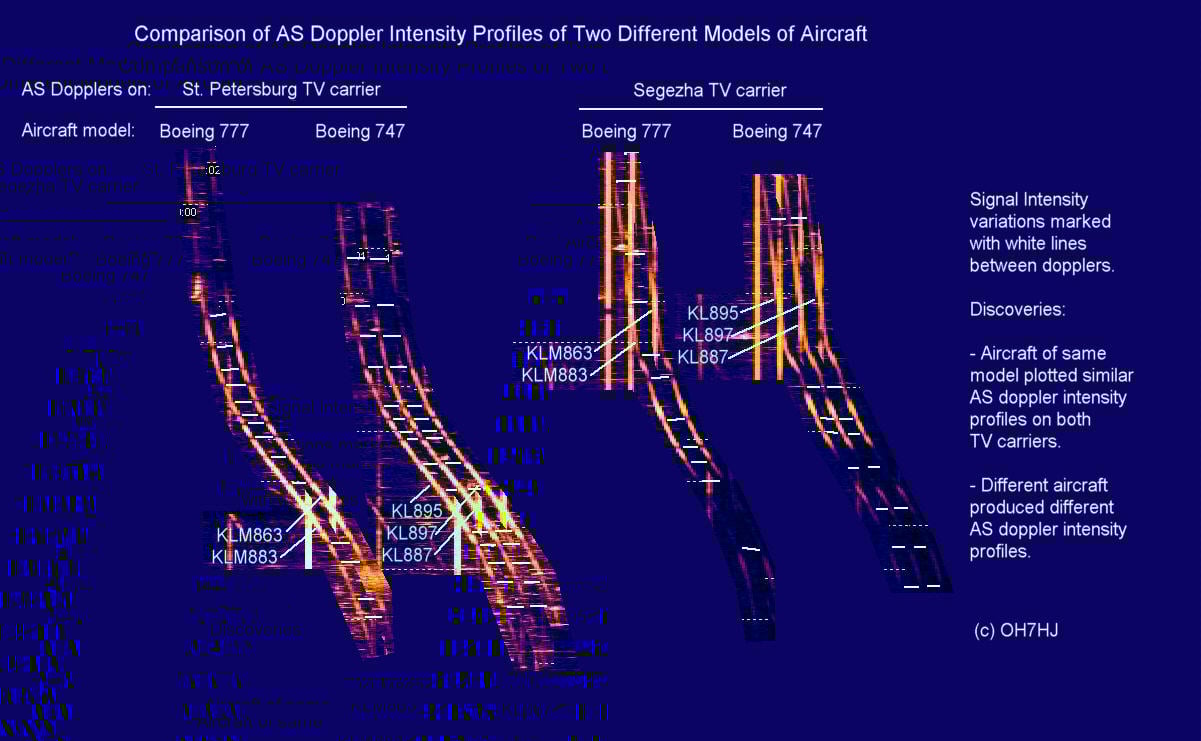
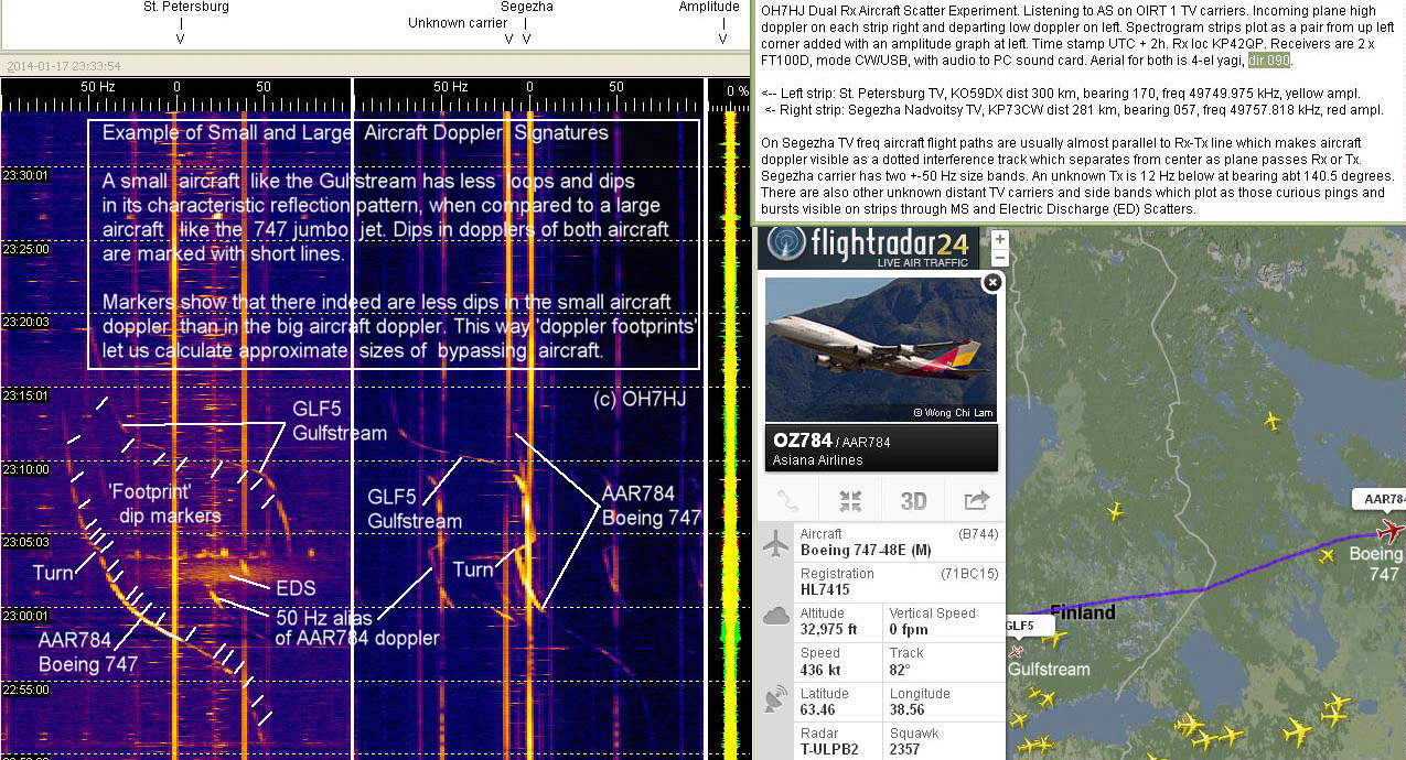
Over on a Finnish aircraft spotting forum, one poster OH7HJ has been using the “Aircraft Scatter” technique to fingerprint individual aircraft (in Finnish, use Google Translate to read in English). Aircraft scatter is a method that can be used to detect aircraft via strong radio signals that are reflected by the aircraft body. OH7HJ shows that each different type of aircraft will present a different reflection intensity at different points of the reflection, allowing each aircraft to be uniquely identified.
In the thread the original poster used a standard hardware radio, but an RTL-SDR dongle or other software defined radio could also be used. He tuned to a strong analogue TV carrier and plotted the audio spectrograph in Spectrum Lab. If analogue TV is no longer available in your country other strong signals such as amateur radio beacons or radar signal carriers could also be used for aircraft scatter.
Below we show a small selection of some of the interesting images from page 9 of the thread, please see the actual thread for the rest. There is also more information and images contained in the other pages of the discussion thread too.
Fingerprinting a Boeing 777 with aircraft scatterComparing aircraft scatter intensity profilesComparing large and small aircraft with aircraft scatter
Now over on YouTube William has uploaded a new video that continues his series on decoding VOR and navigation radio signals. This time he focuses on ILS or Instrument Landing System signals. The ILS is a radio system that is used to help aircraft find and land on the runway safely even in reduced visibility situations such as rain and fog. William’s video explains how ILS works and also shows how he is able to make use of the ILS signal in GNU Radio to extract navigation information.
Over on YouTube user hpux735 has uploaded a video where he explores the feasibility of receiving VOR radio navigation signals using GNU Radio and an RTL-SDR. VOR is an acronym for VHF Omni Directional Radio Range and is an older method of navigation used by aircraft which is quickly being made redundant due to GPS navigation. VOR uses two signals, one master omnidirectional signal and one rotating directional signal. By doing some calculations on the received phase of these two signals it is possible to determine the angle of the aircraft from the transmitter.
In the video hpux735 explains and discusses the VOR signal and also shows how to use these signals for navigation with an RTL-SDR and GNU Radio flowchart. To receive the VOR signal he uses an RTL-SDR to record the VOR signal while he drives around with a car. Then later he uses his GNU Radio program to generate a plot that shows when he is moving and in which direction.
hpux735 has also uploaded some supplemental material over on his blog. In the future he hopes to correlate his VOR results with GPS coordinates that he will take whilst actually flying around.
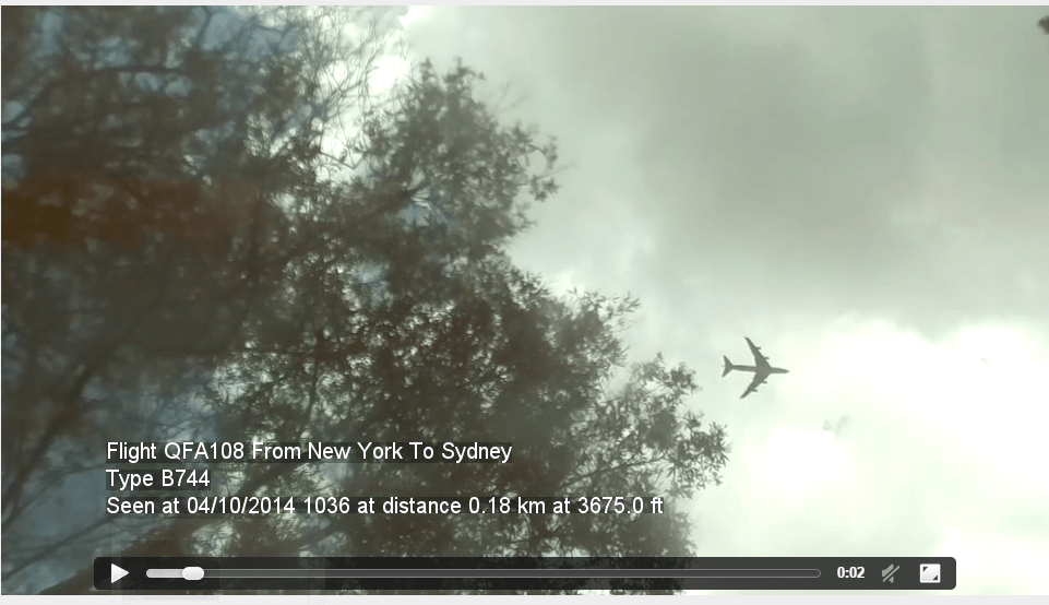
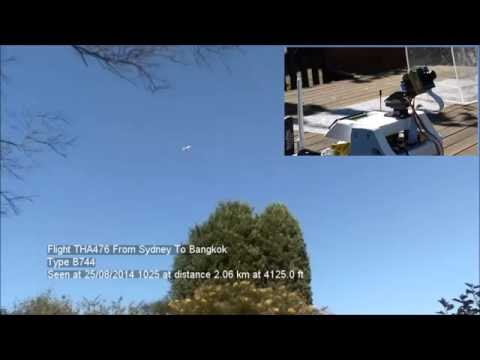
Simon’s project works by using the RTL-SDR connected to the Raspberry Pi as an ADS-B receiver. From the ADS-B signals the current coordinates of nearby aircraft can be determined. Then by using some coordinate math, the Raspberry Pi can be told to point its camera in the direction of the aircraft. As well as videoing the passing aircraft, the Raspberry Pi also overlays text on to the video showing information such as flight number, source and destination airports, aircraft type, elevation and distance and date of observation.
In addition to all that, his software also automatically uploads the recorded videos onto his website. Here you can see the latest and closest video captures his system has performed.
On this episode of Hak5, a popular YouTube technology channel, Shannon shows two Android based ADS-B RTL-SDR apps that we have mentioned on this blog previously. One is “ADS-B on USB SDR RTL” and the other is Avare ADS-B. Both are ADS-B apps that will display real time airplane positions on a map.
To run these apps you need a RTL-SDR dongle, a USB OTG cable and an Android phone.
Cellular Testing Tools and Mobile SDR Apps, Hak5 1708