Skies-ADSB Updated to V2.0.3
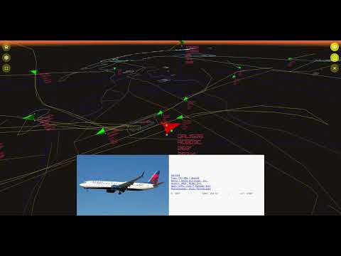
Back in 2022, we first posted about the release of skies-adsb, a browser-based app that uses ADS-B data from an RTL-SDR to provide a 3D view of the air traffic around your area. Recently skies-adsb has been updated from version 1 to version 2, bringing with it several improvements.
The new improvements include:
- Generate custom GeoJSON map layers from Natural Earth, FAA, and OpenStreetMap data
- Aircraft trails visualization
- Enhanced map renderer with multi-layer vector support:
- Aerodromes
- Airspaces
- States / Provinces
- Counties
- Urban areas
- Roads
- Rivers
- Lakes
- New aircraft follow camera controls
The YouTube video below by the author demonstrates some of the new features.