Radwave Beta: Android RTL-SDR RF Analyzer App with Spectrum Pause and Rewind Features
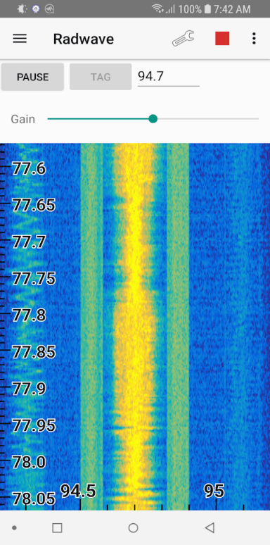
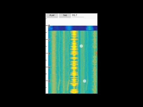
Radwave is a recently released Android App for RTL-SDR dongles. It provides a real time waterfall of the RF spectrum, and it's defining feature is that you can easily zoom, pause and rewind the spectrum at any time. The software is currently in beta, and doesn't demodulate any signals, but the work and ideas behind the spectrum display features is really interesting.
Radwave utilizes RTL-SDR dongles and the RTL2832U driver app to allow people to interactively explore the RF spectrum. You can dynamically zoom in and out in time and frequency, pause, and go back in time - all without losing any samples. If you find something cool, tag it and share with friends.
Radwave core technology is its interactive real-time spectrogram. It shows all the spectrum - utilizing every sample1 - for the entire collection2. Frequencies are aligned over time as you change the RF center frequency3, helping you make sense of what you see.
1 Adjacent non-overlapping DFT windows
2 Up to device limitations
3 Alignment limited by buffer uncertainty
![osmo-fl2k - the [evil] transmit-side brother of RTL-SDR](https://www.rtl-sdr.com/wp-content/plugins/wp-youtube-lyte/lyteCache.php?origThumbUrl=https%3A%2F%2Fi.ytimg.com%2Fvi%2FGryXF92C-Ds%2F0.jpg)