Using the Don’t Look Up Tool to Eavesdrop on Insecure Private Satellite Communications
Over on YouTube, Rob VK8FOES has uploaded a video showing how to install and use the "dontlookup" open-source Linux Python research tool for evaluating satellite IP link security. Back in October, we posted about a new Wired article that discussed how many geostationary satellites are broadcasting sensitive, unencrypted data in the clear and how a cheap DVB-S2 receiver and satellite dish can be used to eavesdrop on them.
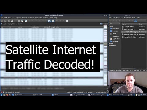
In the video, Rob discusses the new dontlookup tool, which is an excellent one-stop shop open-source tool for parsing IP data from these satellites. He goes on to show the full steps on how to install and use the tool in Linux. The end result is private internet satellite data being visible in Wireshark (blurred in the video for legal reasons). In the video description, Rob writes:
I thought I would make a video showcasing this new open-source Python tool for Linux. 'Don't look up' is the result of a research campaign conducted by a group of cyber security researchers from the USA for decoding DVB-S2 satellite data transponders.
Geostationary communications satellites are somewhat of a 'perfect target' to malicious threat actors, due to their downlink signals covering large portions of earth surface. This gives attackers are large attack surface to intercept IP traffic being transmitted from space. To most peoples surprise, little-to-no security, such as encryption, are being used on these data transponders!
This is all old news to myself, and the fans of my YouTube channel that have been following my TV-satellite hobby for the past couple of years. Most of this was already possible with consumer-grade satellite equipment and a Python application called GSExtract. However, the scope of GSExtract was a lot more narrower than that of DontLookUp, with the developers claiming to have achieved an exponential packet recovery rate compared to GSExtract.
Join me in this video today where I will be showing my users how to patch and build the TBS5927 USB satellite receiver drivers for RAW data capturing. I'll also be showcasing the software application called 'DVBV5-Zap' which interfaces with our satellite receiver to capture RAW data from a satellite. And finally, I will finish-off the video by demonstrating the actual usage of DontLookUp itself. To make the tutorial as accessible as possible, I'm doing the entire process inside a Linux virtual machine!
This tutorial will probably only work in DragonOS FocalX R37 Linux by the wonderful @cemaxecuter. You are welcome to try on other Linux distributions, but your mileage will vary! Also, due to the TBS5927 using something called a 'Isochronous Endpoint', it's only possible to use this satellite receiver via USB Passthrough in VMWare versions 17.5 and above. VirtualBox does not support Isochronous USB Endpoints in any version. It's always best to run Linux on 'bare-metal' by installing it directly to your PC's internal SSD, or running it from a bootable USB thumb drive.
Please understand that if you own an internal PCI-E satellite receiver card from TBS, it is not possible to 'pass it through' to Linux running inside in a Type-2 Hypervisor (VMware, VirtualBox etc.) Installing Linux on bare-metal is the only hope for PCI-E card owners. Thanks very much for watching!
HARDWARE:
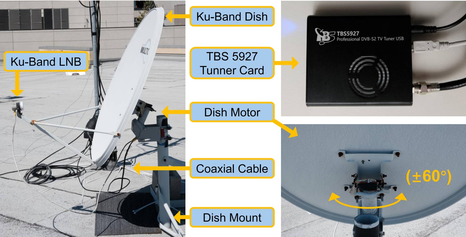
TBS5927 USB Satellite Receiver
90cm 'Foxtel' Satellite Dish
Golden Media GM202+ LNB
Hills RG-6 Coaxial Cable (F-Type Connectors, 75 Ohm)SOFTWARE:
VMWare Workstation 17.6.2
DragonOS FocalX R37 Linux
TBS 'Linux_Media' Drivers
'RAW Data Handling' Patch
DVBV5-Zap
DontLookUp
If you're interested in this topic, Rob's YouTube channel has many videos on this topic that are worth checking out.