WOW@Home: A Global Network of RTL-SDR Based Radio Telescopes Looking for Alien Technosignatures
The Wow! signal is a famous, strong, and unexplained radio signal detected in 1977 by the Big Ear radio telescope in Ohio, lasting 72 seconds and appearing to originate from the constellation Sagittarius. Its origin remains unknown, with some speculating that it could be an extraterrestrial technosignature. Upon reviewing the signal data, Astronomer Jerry R. Ehman discovered the powerful signal burst in the readout and wrote a large "Wow!" next to it, unintentionally coining the name.
Wow@Home is a new project that aims to coordinate a network of small radio telescopes globally, in the hopes of increasing our chances of detecting interesting astrophysical and technosignature events, such as the Wow! event.
A network of small radio telescopes offers several distinct advantages compared to large professional observatories. These systems are low-cost and can operate autonomously around the clock, making them ideal for continuous monitoring of transient events or long-duration signals that professional telescopes cannot commit to observing full-time.
Their geographic distribution enables global sky coverage and coordinated observations across different time zones, which is especially valuable for validating repeating or time-variable signals. Coincidence detection across multiple stations helps reject local radio frequency interference (RFI), increasing confidence in true astrophysical or technosignature transient events.
These networks are also highly scalable, resilient to single-point failures, and capable of rapid response to external alerts. Furthermore, they are cost-effective, engaging, and accessible, ideal for education, citizen science, and expanding participation in radio astronomy.
However, these systems also come with notable limitations when compared to professional telescopes. They have significantly lower sensitivity, limiting their ability to detect faint or distant sources. Their angular resolution is poor due to smaller dish sizes and wide beamwidths, making precise source localization difficult.
Calibration can be inconsistent across stations, and frequency stability or dynamic range may not match the performance of professional-grade equipment. Additionally, without standardized equipment and protocols, data quality and interoperability can vary across the network.
Despite these constraints, when thoughtfully coordinated, such networks can provide valuable complementary observations to professional facilities.
The team note that the Wow! signal was strong enough that it could have been detected by a small home radio telescope. They go on to make the case that we could be missing out on detecting many compelling signals simply because radio telescopes aren't watching every part of the sky simultaneously.
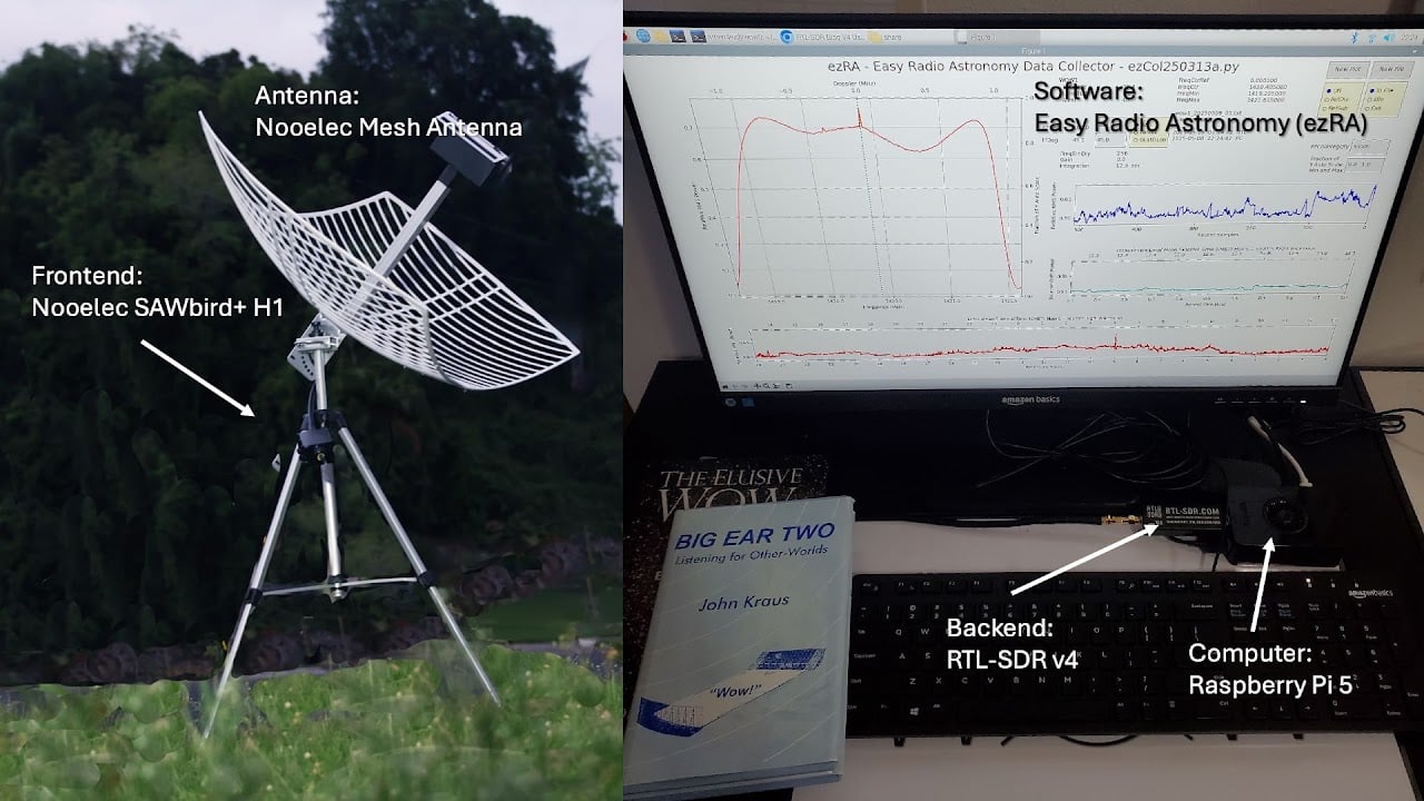
The project will monitor the Hydrogen Line frequency for interesting signals. Currently, the team is using a WiFi grid dish and an external LNA as the radio telescope hardware, but they also aim to evaluate our Discovery Dish with H-Line feed.