Tagged: VOR

SDRangel Now Available on Android: Mobile ADS-B, AIS, APT, Digital Voice, POCSAG, APRS, RS41 Radiosonde Decoders

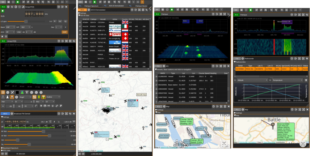
SDRangel is a free open source software defined radio program that is compatible with many SDRs, including RTL-SDRs. SDRAngel is set apart from other programs because of it's huge swath of built in demodulators and decoders.

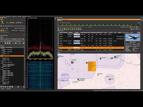
Thank you to reader Jon for writing in and noting that SDRangel has recently been released for Android as a free Google Play download. This is an amazing development that could open up many doors into portable decoding setups as the Android version supports almost every decoder implemented on the desktop version. Jon writes:

It includes most of the functionality of the desktop version of SDRangel, including:

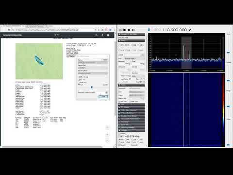
  • AM, FM, SSB, Broadcast FM and DAB, AIS, ADS-B, Digital Voice (DMR, dPMR, D-Star, FreeDV), Video (DVB-S, DVB-S2, NTSC, PAL), VOR, LoRa, M17, Packet (AX.25), Pager (POCSAG), Radiosonde (RS41), Time signal (MSF, DCF77, TDF and WWVB) modems.
  • RTL SDR, Airspy, Airspy HF, LimeSDR, HackRF and SDRplay support via USB OTG as well as networked SDRs
  • 2D and 3D signal analysis in both time and frequency domain with statistical measurements of SNR, THD, THD+N, SINAD, SFDR and channel power
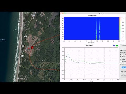
  • Satellite tracker, star tracker, maps and rotator controller

It should work on Android 6 and up. It’s a straight port of the desktop application, so although it will run on a phone, probably best used on a large tablet with a stylus or mouse.

SDRangel on Android
SDRangel on Android

SDRAngel Features Overview: ADS-B, APT, DVB-S, DAB+, AIS, VOR, APRS, and many more built-in apps

SDRAngel is a general purpose software defined radio program that is compatible with most SDRs including the RTL-SDR. We've posted about it several times before on the blog, however we did not realize how much progress has occurred with developing various built in plugins and decoders for it.

Thanks to Jon for writing in and sharing with us a demonstration video that the SDRAngel team have released on their YouTube channel. From the video we can see that SDRAngel now comes stock with a whole host of built in decoders and apps for various radio applications making it close to an all-in-one SDR platform. The built in applications include:

  • ADS-B Decoder: Decodes aircraft ADS-B data and plots aircraft positions on a map
  • NOAA APT Decoder: Decodes NOAA weather satellite images (in black and white only)
  • DVB-S: Decodes and plays Digital TV DVB-S and DVB-S2 video
  • AIS: Decodes marine AIS data and plots vessel positions on a map
  • VOR: Decodes VOR aircraft navigational beacons, and plots bearing lines on a map, allowing you to determine your receivers position.
  • DAB+: Decodes and plays DAB digital audio signals
  • Radio Astronomy Hydrogen Line: With an appropriate radio telescope connected to the SDR, integrates and displays the Hydrogen Line FFT with various settings, and a map of the galaxy showing where your dish is pointing. Can also control a dish rotator.
  • Radio Astronomy Solar Observations: Similar to the Hydrogen line app, allows you to make solar measurements.
  • Broadcast FM: Decoding and playback. Includes RDS decoding.
  • Noise Figure Measurements: Together with a noise source you can measure the noise figure of a SDR.
  • Airband Voice: Receive multiple Airband channels simultaneously
  • Graves Radar Tracker: For Europeans, track a satellite and watch for reflections in the spectrum from the French Graves space radar. 
  • Radio Clocks: Receive and decode accurate time from radio clocks such as MSF, DCF77, TDF and WWVB.
  • APRS: Decode APRS data, and plot APRS locations and moving APRS enabled vehicles on a map with speed plot.
  • Pagers: Decode POCSAG pagers
  • APRS/AX.25 Satellite: Decode APRS messages from the ISS and NO-84 satellites, via the built in decoder and satellite tracker.
  • Channel Analyzer: Analyze signals in the frequency and time domains
  • QSO Digital and Analog Voice: Decode digital and analog voice. Digital voice handled by the built in DSD demodulator, and includes DMR, dPMR and D-Star.
  • Beacons: Monitor propagation via amateur radio beacons, and plot them on a map.

We note that the video doesn't show the following additional features such as an analog TV decoder, the SDRAngel "ChirpChat" text mode, a FreeDV decoder and several other features.

An Open Source VOR Receiver for Airspy and RTL-SDR

Thank you to Thierry Leconte (TLeconte) for writing in and submitting his new command line based open source software called vortrack. Vortrack is a simple VOR decoder which calculates the angle towards the VOR. It is compatible with both RTL-SDR and Airspy radios, and runs on Linux.

In the past we've seen several other posts about RTL-SDRs being used to decode VOR signals, but Thierry's implementation appears to be the easiest way to get a bearing straight away. You'll get the most use out of the software if you install it on a portable device like a Raspberry Pi and take it out for a drive as you'll be able to see the VOR angle changing then.

VOR stands for VHF Omnidirectional Range and is a way to help aircraft navigate by using fixed ground based beacons. The beacons are specially designed in such a way that the aircraft can use the beacon to determine a bearing towards the VOR transmitter. VOR beacons are found between 108 MHz and 117.95 MHz, and it's possible to view the raw signal in SDR#.

A DVOR Ground Station at an Airport. Source Wikipedia.

Using an RTL-SDR to decode VOR Aircraft Navigation Beacons in Real Time

VOR stands for VHF Omnidirectional Range and is a way to help aircraft navigate by using fixed ground based beacons. The beacons are specially designed in such a way that the aircraft can use the beacon to determine a bearing towards the VOR transmitter. VOR beacons are found between 108 MHz and 117.95 MHz, and it's possible to view the raw signal in SDR#.

Over on RadioJitter author Arnav Mukhopadhyay has uploaded a post describing how to decode VOR into a bearing in real time using an RTL-SDR dongle. His post first explains how VOR works, and then goes on to show an experimental set up that he's created using a GNU Radio program.  With the software he was able to decode an accurate bearing towards the VOR transmitter at a nearby airport.

Arnavs post is a preview of an academic paper that he's worked on, and the full paper and code is available by request on the radiojitter post. We've also seen on YouTube that Arnav has uploaded a video showing the software working in action, and we have embedded it below.

Bearing to nearby airport VOR transmitter determined with an RTL-SDR and GNU Radio.

Showing what VOR and ILS Aviation Signals Look like in SDR#

Over on YouTube user RedWhiteandPew has uploaded two videos showing what VOR and ILS signals look like in SDR# with an RTL-SDR dongle. VOR and ILS are both radio signals used for navigation in aviation. 

VOR stands for VHF Omnidirectional Range and is a way to help aircraft navigate by using fixed ground based beacons. The beacons are specially designed in such a way that the aircraft can use the beacon to determine a bearing towards the VOR transmitter. VOR beacons are found between 108 MHz and 117.95 MHz.

RedWhiteandPew writes:

Here I am picking up the VOR beacon from KSJC. The coolest part is at the end of the video. I believe the signal moving back and forth is caused by the Doppler effect, because VORs transmit their signals in a circular pattern. The VOR wiki article has a GIF that shows how it works here https://en.wikipedia.org/wiki/VHF_omn…. If you play and pause the video at different points before I zoom in, you can see that the two signals on the side are the opposite phase.

Listening to a VOR on a Scanner || RTL-SDR Dongle

ILS stands for Instrument Landing System and is a radio system that enables aircraft to land on a runway safely even without visual contact. It works by using highly directional antennas to create four directional lobes (two in the horizontal plane, two in the vertical) that are used to try and ensure the aircraft is centered and leveled on the approach correctly. The ILS frequencies are at 108.1 – 111.95 MHz for the horizontal ‘localizer’, and at 329.15-335.0 MHz for the vertical ‘glide slope’.

RedWhiteandPew writes:

Here I have tuned into one of KSJC’s ILS frequencies. You are able to hear the faint identifier beeping transmitting its ISL ID code which is ISJC. For comparison, I used to morse code translator website.

The reason I am hearing ISJC and not ISLV even though they are on the same frequency is because the localizers transmitting the signal are directional along the length of the runway. Since I am located to the south east of the airport, and I am within its transmitting beam, I am able to listen to it on a scanner.

Listening to an ILS Localizer (RTL-SDR Dongle)

If you’re interested in these signals then this previous post about actually decoding them might be of interest to you.

Decoding and Plotting VOR Signals with an RTL-SDR: Part 4

Previously we posted about Will’s (aka hpux735) project [1] [2] where he has been using an RTL-SDR dongle to help understand and decode aircraft navigation VOR signals. VOR is an acronym for VHF Omni Directional Radio Range and is an older method of navigation used by aircraft which is used to provide a heading towards a VOR transmitter.

In his latest video, Will has been able to finish his code which allows him to actually plot some VOR data that he obtained from a flight on a map. In the video the VOR data is used to draw a heading line between three recorded VOR transmitters and the aircraft. The video clearly shows the accuracy of the VOR signals (about 1 degree) and shows what happens to the heading accuracy when reception is bad.

VORs and SDRs Part 4: Fusion!

Decoding Aviation VOR and ILS Signals with RTL-SDR

Previously we’ve posted about how hpux735 (aka William) was able to use an RTL-SDR to decode an aviation VOR navigation signal using GNU Radio and an RTL-SDR. VOR is an acronym for VHF Omni Directional Radio Range and is an older method of navigation used by aircraft.

Now over on YouTube William has uploaded a new video that continues his series on decoding VOR and navigation radio signals. This time he focuses on ILS or Instrument Landing System signals. The ILS is a radio system that is used to help aircraft find and land on the runway safely even in reduced visibility situations such as rain and fog. William’s video explains how ILS works and also shows how he is able to make use of the ILS signal in GNU Radio to extract navigation information.

William has also uploaded some supplemental material to his blog including the GNU Radio grc file and the baseband ILS signal data he collected whilst flying.

VORs and SDRs Part 3: ILS

Receiving VOR Radio Navigation with an RTL-SDR and GNU Radio

Over on YouTube user hpux735 has uploaded a video where he explores the feasibility of receiving VOR radio navigation signals using GNU Radio and an RTL-SDR. VOR is an acronym for VHF Omni Directional Radio Range and is an older method of navigation used by aircraft which is quickly being made redundant due to GPS navigation. VOR uses two signals, one master omnidirectional signal and one rotating directional signal. By doing some calculations on the received phase of these two signals it is possible to determine the angle of the aircraft from the transmitter.

In the video hpux735 explains and discusses the VOR signal and also shows how to use these signals for navigation with an RTL-SDR and GNU Radio flowchart. To receive the VOR signal he uses an RTL-SDR to record the VOR signal while he drives around with a car. Then later he uses his GNU Radio program to generate a plot that shows when he is moving and in which direction.

hpux735 has also uploaded some supplemental material over on his blog. In the future he hopes to correlate his VOR results with GPS coordinates that he will take whilst actually flying around.

VORs and SDRs part 1: Playing with angles